Frankenburg geodata
Frankenburg (Upper Austria) is a seat of a third-order administrative division; located in Austria in Europe/Vienna (GMT+2) time zone. With population of 2,122 people, there are 574 cities with bigger population in this country. Compared to other cities in Austria, 70.6% of cities are located further ↓South; 75% of cities are located further →East and 59.6% of cities have lower elevation than Frankenburg. Note1
Administrative division(s):
- Level 1: Upper Austria
- Level 2: Politischer Bezirk Vöcklabruck
- Level 3: Frankenburg am Hausruck


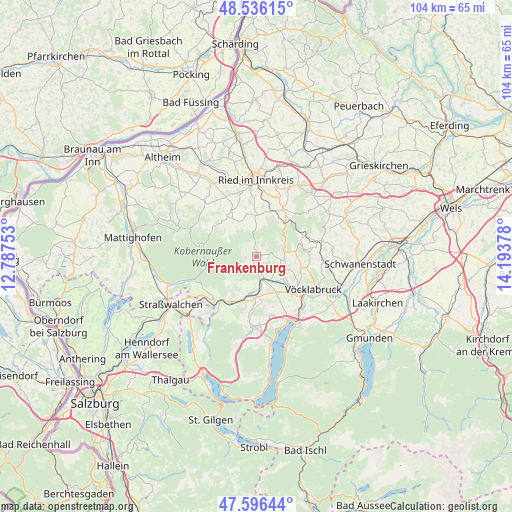
Frankenburg GPS coordinates[2]
48° 4' 6.384" North, 13° 29' 26.34" East
| Map corner | latitude | longitude |
|---|---|---|
| Upper-left | 48.53615°, | 12.78753° |
| Center: | 48.06844°, | 13.49065° |
| Lower-right: | 47.59644°, | 14.19378° |
| Map W x H: | 104.5×104.5 km | = 64.9×64.9mi |
| max Lat: | 48.98333° ⇑29.4% North |
| Frankenburg: | 48.06844° |
| min Lat: | ⇓70.6% South 46.48841° |
| min Long | Frankenburg | max Long |
| 9.57802° | 13.49065° | 17.1° |
| W 25%⇐ | ⇒75% E |
Elevation
Elevation of Frankenburg is 515 m = 1690 ft, and this is 9.5 m = 31 ft above average elevation for this country.
| Max E: |
2140 m = 7021 ft | 40.4% |
| Frankenburg | 515 m 1690 ft | |
| Avg. | 505.5 m = 1658 ft | |
Min E: |
118 m = 387 ft | 59.6% |
See also: Austria elevation on elevation.city.
Geographical zone
Frankenburg is located in North temperate zone (between Tropic of Cancer and the Arctic Circle). Distance of this North polar circle is 2056.5 km =1277.8 mi to North.| Distance of | km | miles | from Frankenburg |
|---|---|---|---|
| North Pole | 4662.4 | 2897.1 | to North |
| Arctic Circle | 2056.5 | 1277.8 | to North |
| Tropic Cancer | 2738.8 | 1701.8 | to South |
| Equator | 5344.7 | 3321 | to South |


Nearby cities:
15 places around Frankenburg: (largest is in red/bold)
• Ampflwang
5.9 km =3.7 mi,  73°
73°
• Fornach
6.8 km =4.2 mi,  221°
221°
• Gampern
10 km =6.2 mi,  151°
151°
• Neukirchen an der Vöckla
4.7 km =2.9 mi,  131°
131°
• Pattigham
9.7 km =6 mi,  357°
357°
• Pfaffing
5.7 km =3.5 mi,  191°
191°
• Pramet
8.3 km =5.2 mi, 358°
• Puchlkirchen am Trattberg
6.6 km =4.1 mi,  113°
113°
• Redleiten
2.2 km =1.4 mi,  311°
311°
• Schildorn
8.8 km =5.5 mi,  346°
346°
• Siedlung
5.5 km =3.4 mi, 72°
• Ungenach
9.5 km =5.9 mi,  104°
104°
• Vöcklamarkt
7.3 km =4.5 mi,  183°
183°
• Waldzell
8.8 km =5.5 mi,  327°
327°
• Zell am Pettenfirst
8.2 km =5.1 mi,  80°
80°
Sources, notices
• [Note1] Compared only with cities in Austria existing in our database
• [Src1] Map data: © OpenStreetMap contributors (CC-BY-SA)
• [Src2] Other city data from geonames.org with taken over terms of usage.
• [Src3] Geographical zone / Annual Mean Temperature by Robert A. Rohde @ Wikipedia
