Olbendorf geodata
Olbendorf (Burgenland) is a seat of a third-order administrative division; located in Austria in Europe/Vienna (GMT+2) time zone. With population of 1,449 people, there are 866 cities with bigger population in this country. Compared to other cities in Austria, 74.1% of cities are located further ↑North; 86% of cities are located further ←West and 73.7% of cities have higher elevation than Olbendorf. Note1
Administrative division(s):
- Level 1: Burgenland
- Level 2: Politischer Bezirk Güssing
- Level 3: Olbendorf


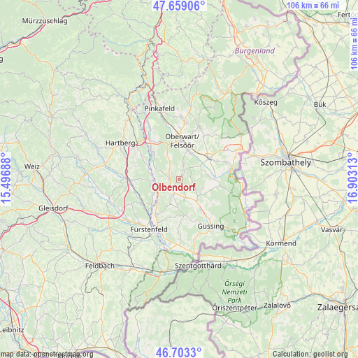
Olbendorf GPS coordinates[2]
47° 10' 59.988" North, 16° 12' 0" East
| Map corner | latitude | longitude |
|---|---|---|
| Upper-left | 47.65906°, | 15.49688° |
| Center: | 47.18333°, | 16.2° |
| Lower-right: | 46.7033°, | 16.90313° |
| Map W x H: | 106.3×106.3 km | = 66.1×66.1mi |
| max Lat: | 48.98333° ⇑74.1% North |
| Olbendorf: | 47.18333° |
| min Lat: | ⇓25.9% South 46.48841° |
| min Long | Olbendorf | max Long |
| 9.57802° | 16.2° | 17.1° |
| W 86%⇐ | ⇒14% E |
Elevation
Elevation of Olbendorf is 310 m = 1017 ft, and this is 195.5 m = 641 ft below average elevation for this country.
| Max E: |
2140 m = 7021 ft | 73.7% |
| Avg. | 505.5 m = 1658 ft | |
| Olbendorf | 310 m = 1017 ft | |
Min E: |
118 m = 387 ft | 26.3% |
See also: Austria elevation on elevation.city.
Geographical zone
Olbendorf is located in North temperate zone (between Tropic of Cancer and the Arctic Circle). Distance of this North polar circle is 2154.9 km =1339 mi to North.| Distance of | km | miles | from Olbendorf |
|---|---|---|---|
| North Pole | 4760.8 | 2958.2 | to North |
| Arctic Circle | 2154.9 | 1339 | to North |
| Tropic Cancer | 2640.4 | 1640.7 | to South |
| Equator | 5246.3 | 3259.9 | to South |


Nearby cities:
15 places around Olbendorf: (largest is in red/bold)
• Bocksdorf
4.8 km =3 mi,  200°
200°
• Burgauberg
7 km =4.3 mi,  235°
235°
• Güttenbach
7.6 km =4.7 mi,  112°
112°
• Hackerberg
6.6 km =4.1 mi,  286°
286°
• Heugraben
7.3 km =4.5 mi,  185°
185°
• Litzelsdorf
3.5 km =2.2 mi,  322°
322°
• Neuberg im Burgenland
4.8 km =3 mi, 109°
• Neudau
7.5 km =4.7 mi,  263°
263°
• Neudauberg
6.2 km =3.9 mi, 257°
• Oberdorf im Burgenland
3.9 km =2.4 mi,  18°
18°
• Ollersdorf im Burgenland
2.5 km =1.6 mi,  270°
270°
• Rohr im Burgenland
7.8 km =4.8 mi, 198°
• Stegersbach
3.1 km =1.9 mi,  233°
233°
• Stinatz
5.5 km =3.4 mi, 293°
• Unterwart
7.8 km =4.8 mi, 18°
Sources, notices
• [Note1] Compared only with cities in Austria existing in our database
• [Src1] Map data: © OpenStreetMap contributors (CC-BY-SA)
• [Src2] Other city data from geonames.org with taken over terms of usage.
• [Src3] Geographical zone / Annual Mean Temperature by Robert A. Rohde @ Wikipedia
