Heugraben geodata
Heugraben (Burgenland) is a seat of a third-order administrative division; located in Austria in Europe/Vienna (GMT+2) time zone. With population of 216 people, there are 2837 cities with bigger population in this country. Compared to other cities in Austria, 77.8% of cities are located further ↑North; 85.8% of cities are located further ←West and 84.9% of cities have higher elevation than Heugraben. Note1
Administrative division(s):
- Level 1: Burgenland
- Level 2: Politischer Bezirk Güssing
- Level 3: Heugraben


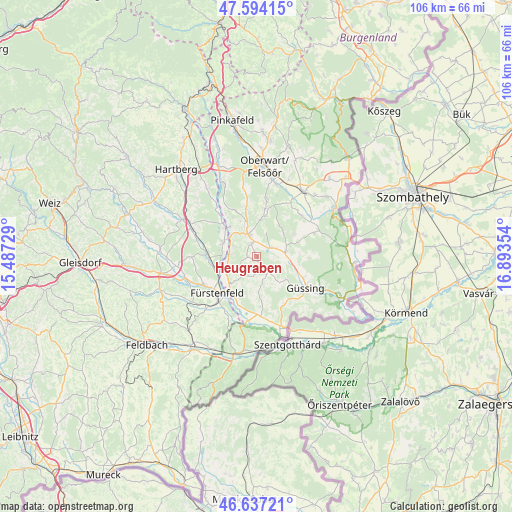
Heugraben GPS coordinates[2]
47° 7' 4.188" North, 16° 11' 25.476" East
| Map corner | latitude | longitude |
|---|---|---|
| Upper-left | 47.59415°, | 15.48729° |
| Center: | 47.11783°, | 16.19041° |
| Lower-right: | 46.63721°, | 16.89354° |
| Map W x H: | 106.4×106.4 km | = 66.1×66.1mi |
| max Lat: | 48.98333° ⇑77.8% North |
| Heugraben: | 47.11783° |
| min Lat: | ⇓22.2% South 46.48841° |
| min Long | Heugraben | max Long |
| 9.57802° | 16.19041° | 17.1° |
| W 85.8%⇐ | ⇒14.2% E |
Elevation
Elevation of Heugraben is 247 m = 810 ft, and this is 258.5 m = 848 ft below average elevation for this country.
| Max E: |
2140 m = 7021 ft | 84.9% |
| Avg. | 505.5 m = 1658 ft | |
| Heugraben | 247 m = 810 ft | |
Min E: |
118 m = 387 ft | 15.1% |
See also: Austria elevation on elevation.city.
Geographical zone
Heugraben is located in North temperate zone (between Tropic of Cancer and the Arctic Circle). Distance of this North polar circle is 2162.2 km =1343.5 mi to North.| Distance of | km | miles | from Heugraben |
|---|---|---|---|
| North Pole | 4768.1 | 2962.8 | to North |
| Arctic Circle | 2162.2 | 1343.5 | to North |
| Tropic Cancer | 2633.1 | 1636.1 | to South |
| Equator | 5239 | 3255.4 | to South |


Nearby cities:
15 places around Heugraben: (largest is in red/bold)
• Bocksdorf
2.9 km =1.8 mi,  340°
340°
• Burgau
7.6 km =4.7 mi,  291°
291°
• Burgauberg
6.1 km =3.8 mi,  303°
303°
• Deutsch Kaltenbrunn
5.2 km =3.2 mi,  239°
239°
• Deutsch Tschantschendorf
7.3 km =4.5 mi,  105°
105°
• Kukmirn
4.9 km =3 mi,  162°
162°
• Limbach im Burgenland
6 km =3.7 mi,  197°
197°
• Neuberg im Burgenland
7.8 km =4.8 mi,  43°
43°
• Neusiedl bei Güssing
2.1 km =1.3 mi, 195°
• Olbendorf
7.3 km =4.5 mi,  5°
5°
• Ollersdorf im Burgenland
7.5 km =4.7 mi,  346°
346°
• Rohr im Burgenland
1.8 km =1.1 mi,  265°
265°
• Rohrbrunn
5.7 km =3.5 mi,  277°
277°
• Sankt Michael im Burgenland
6.2 km =3.9 mi,  79°
79°
• Stegersbach
5.7 km =3.5 mi, 341°
Sources, notices
• [Note1] Compared only with cities in Austria existing in our database
• [Src1] Map data: © OpenStreetMap contributors (CC-BY-SA)
• [Src2] Other city data from geonames.org with taken over terms of usage.
• [Src3] Geographical zone / Annual Mean Temperature by Robert A. Rohde @ Wikipedia
