Stegersbach geodata
Stegersbach (Burgenland) is a seat of a third-order administrative division; located in Austria in Europe/Vienna (GMT+2) time zone. With population of 2,658 people, there are 440 cities with bigger population in this country. Compared to other cities in Austria, 75% of cities are located further ↑North; 85% of cities are located further ←West and 77.5% of cities have higher elevation than Stegersbach. Note1
Administrative division(s):
- Level 1: Burgenland
- Level 2: Politischer Bezirk Güssing
- Level 3: Stegersbach


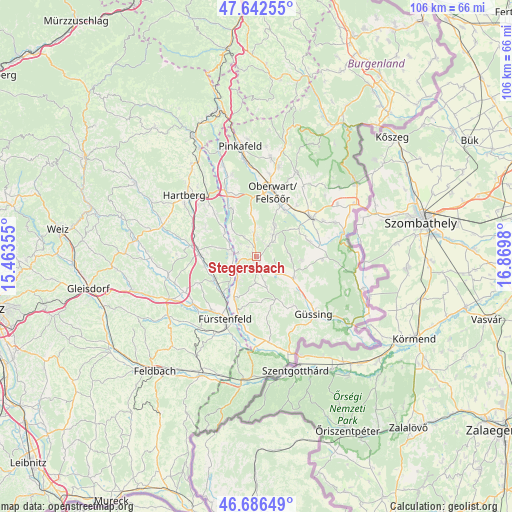
Stegersbach GPS coordinates[2]
47° 10' 0.012" North, 16° 10' 0.012" East
| Map corner | latitude | longitude |
|---|---|---|
| Upper-left | 47.64255°, | 15.46355° |
| Center: | 47.16667°, | 16.16667° |
| Lower-right: | 46.68649°, | 16.8698° |
| Map W x H: | 106.3×106.3 km | = 66.1×66.1mi |
| max Lat: | 48.98333° ⇑75% North |
| Stegersbach: | 47.16667° |
| min Lat: | ⇓25% South 46.48841° |
| min Long | Stegersbach | max Long |
| 9.57802° | 16.16667° | 17.1° |
| W 85%⇐ | ⇒15% E |
Elevation
Elevation of Stegersbach is 286 m = 938 ft, and this is 219.5 m = 720 ft below average elevation for this country.
| Max E: |
2140 m = 7021 ft | 77.5% |
| Avg. | 505.5 m = 1658 ft | |
| Stegersbach | 286 m = 938 ft | |
Min E: |
118 m = 387 ft | 22.5% |
See also: Austria elevation on elevation.city.
Geographical zone
Stegersbach is located in North temperate zone (between Tropic of Cancer and the Arctic Circle). Distance of this North polar circle is 2156.7 km =1340.1 mi to North.| Distance of | km | miles | from Stegersbach |
|---|---|---|---|
| North Pole | 4762.6 | 2959.3 | to North |
| Arctic Circle | 2156.7 | 1340.1 | to North |
| Tropic Cancer | 2638.5 | 1639.5 | to South |
| Equator | 5244.4 | 3258.7 | to South |


Nearby cities:
15 places around Stegersbach: (largest is in red/bold)
• Bocksdorf
2.8 km =1.7 mi,  162°
162°
• Burgau
5.9 km =3.7 mi,  243°
243°
• Burgauberg
3.9 km =2.4 mi, 237°
• Hackerberg
5.3 km =3.3 mi,  314°
314°
• Heugraben
5.7 km =3.5 mi, 161°
• Litzelsdorf
4.6 km =2.9 mi,  4°
4°
• Neuberg im Burgenland
7.1 km =4.4 mi,  87°
87°
• Neudau
5 km =3.1 mi,  281°
281°
• Neudauberg
3.6 km =2.2 mi, 278°
• Oberdorf im Burgenland
6.7 km =4.2 mi,  34°
34°
• Olbendorf
3.1 km =1.9 mi,  53°
53°
• Ollersdorf im Burgenland
1.9 km =1.2 mi, 0°
• Rohr im Burgenland
5.6 km =3.5 mi,  180°
180°
• Rohrbrunn
6.1 km =3.8 mi,  219°
219°
• Stinatz
4.7 km =2.9 mi,  327°
327°
Sources, notices
• [Note1] Compared only with cities in Austria existing in our database
• [Src1] Map data: © OpenStreetMap contributors (CC-BY-SA)
• [Src2] Other city data from geonames.org with taken over terms of usage.
• [Src3] Geographical zone / Annual Mean Temperature by Robert A. Rohde @ Wikipedia
