Güttenbach geodata
Güttenbach (Burgenland) is a seat of a third-order administrative division; located in Austria in Europe/Vienna (GMT+2) time zone. With population of 898 people, there are 1435 cities with bigger population in this country. Compared to other cities in Austria, 75.2% of cities are located further ↑North; 88.5% of cities are located further ←West and 78% of cities have higher elevation than Güttenbach. Note1
Administrative division(s):
- Level 1: Burgenland
- Level 2: Politischer Bezirk Güssing
- Level 3: Güttenbach


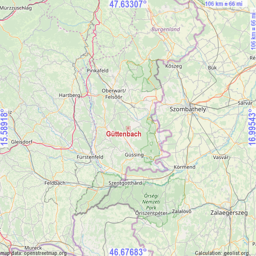
Güttenbach GPS coordinates[2]
47° 9' 25.56" North, 16° 17' 32.28" East
| Map corner | latitude | longitude |
|---|---|---|
| Upper-left | 47.63307°, | 15.58918° |
| Center: | 47.1571°, | 16.2923° |
| Lower-right: | 46.67683°, | 16.99543° |
| Map W x H: | 106.3×106.3 km | = 66.1×66.1mi |
| max Lat: | 48.98333° ⇑75.2% North |
| Güttenbach: | 47.1571° |
| min Lat: | ⇓24.8% South 46.48841° |
| min Long | Güttenbach | max Long |
| 9.57802° | 16.2923° | 17.1° |
| W 88.5%⇐ | ⇒11.5% E |
Elevation
Elevation of Güttenbach is 284 m = 932 ft, and this is 221.5 m = 727 ft below average elevation for this country.
| Max E: |
2140 m = 7021 ft | 78% |
| Avg. | 505.5 m = 1658 ft | |
| Güttenbach | 284 m = 932 ft | |
Min E: |
118 m = 387 ft | 22% |
See also: Austria elevation on elevation.city.
Geographical zone
Güttenbach is located in North temperate zone (between Tropic of Cancer and the Arctic Circle). Distance of this North polar circle is 2157.8 km =1340.8 mi to North.| Distance of | km | miles | from Güttenbach |
|---|---|---|---|
| North Pole | 4763.7 | 2960 | to North |
| Arctic Circle | 2157.8 | 1340.8 | to North |
| Tropic Cancer | 2637.5 | 1638.9 | to South |
| Equator | 5243.4 | 3258.1 | to South |


Nearby cities:
15 places around Güttenbach: (largest is in red/bold)
• Badersdorf
7.4 km =4.6 mi,  49°
49°
• Bocksdorf
8.8 km =5.5 mi,  259°
259°
• Deutsch Tschantschendorf
6.4 km =4 mi,  186°
186°
• Grosspetersdorf
9.3 km =5.8 mi,  11°
11°
• Heugraben
8.9 km =5.5 mi,  240°
240°
• Jabing
9.2 km =5.7 mi,  352°
352°
• Kohfidisch
5.3 km =3.3 mi,  68°
68°
• Mischendorf
4.3 km =2.7 mi,  22°
22°
• Neuberg im Burgenland
2.7 km =1.7 mi,  298°
298°
• Oberdorf im Burgenland
8.7 km =5.4 mi,  319°
319°
• Olbendorf
7.6 km =4.7 mi,  292°
292°
• Ollersdorf im Burgenland
9.9 km =6.2 mi, 287°
• Sankt Michael im Burgenland
3.5 km =2.2 mi,  206°
206°
• Stegersbach
9.6 km =6 mi,  276°
276°
• Tobaj
8.2 km =5.1 mi,  175°
175°
Sources, notices
• [Note1] Compared only with cities in Austria existing in our database
• [Src1] Map data: © OpenStreetMap contributors (CC-BY-SA)
• [Src2] Other city data from geonames.org with taken over terms of usage.
• [Src3] Geographical zone / Annual Mean Temperature by Robert A. Rohde @ Wikipedia
