Ohlsdorf geodata
Ohlsdorf (Upper Austria) is a seat of a third-order administrative division; located in Austria in Europe/Vienna (GMT+2) time zone. With population of 1,093 people, there are 1169 cities with bigger population in this country. Compared to other cities in Austria, 64.1% of cities are located further ↓South; 69.2% of cities are located further →East and 62.2% of cities have lower elevation than Ohlsdorf. Note1
Administrative division(s):
- Level 1: Upper Austria
- Level 2: Politischer Bezirk Gmunden
- Level 3: Ohlsdorf


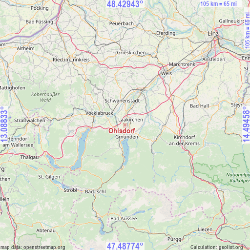
Ohlsdorf GPS coordinates[2]
47° 57' 38.628" North, 13° 47' 29.22" East
| Map corner | latitude | longitude |
|---|---|---|
| Upper-left | 48.42943°, | 13.08833° |
| Center: | 47.96073°, | 13.79145° |
| Lower-right: | 47.48774°, | 14.49458° |
| Map W x H: | 104.7×104.7 km | = 65.1×65.1mi |
| max Lat: | 48.98333° ⇑35.9% North |
| Ohlsdorf: | 47.96073° |
| min Lat: | ⇓64.1% South 46.48841° |
| min Long | Ohlsdorf | max Long |
| 9.57802° | 13.79145° | 17.1° |
| W 30.8%⇐ | ⇒69.2% E |
Elevation
Elevation of Ohlsdorf is 533 m = 1749 ft, and this is 27.5 m = 90 ft above average elevation for this country.
| Max E: |
2140 m = 7021 ft | 37.8% |
| Ohlsdorf | 533 m 1749 ft | |
| Avg. | 505.5 m = 1658 ft | |
Min E: |
118 m = 387 ft | 62.2% |
See also: Austria elevation on elevation.city.
Geographical zone
Ohlsdorf is located in North temperate zone (between Tropic of Cancer and the Arctic Circle). Distance of this North polar circle is 2068.4 km =1285.2 mi to North.| Distance of | km | miles | from Ohlsdorf |
|---|---|---|---|
| North Pole | 4674.3 | 2904.5 | to North |
| Arctic Circle | 2068.4 | 1285.2 | to North |
| Tropic Cancer | 2726.8 | 1694.4 | to South |
| Equator | 5332.7 | 3313.6 | to South |


Nearby cities:
15 places around Ohlsdorf: (largest is in red/bold)
• Altmünster
6.8 km =4.2 mi,  197°
197°
• Desselbrunn
6.9 km =4.3 mi,  346°
346°
• Eck
4.9 km =3 mi, 196°
• Gmunden
4.7 km =2.9 mi,  172°
172°
• Großkufhaus
5.9 km =3.7 mi,  222°
222°
• Gschwandt
4.9 km =3 mi,  125°
125°
• Kleinreith
2.3 km =1.4 mi, 172°
• Laakirchen
3.3 km =2.1 mi,  43°
43°
• Niederstraß
7.5 km =4.7 mi,  322°
322°
• Pinsdorf
3.8 km =2.4 mi, 204°
• Preising
7.3 km =4.5 mi,  301°
301°
• Puchheim
7.1 km =4.4 mi,  308°
308°
• Roitham
7.4 km =4.6 mi,  17°
17°
• Rutzenmoos
6.4 km =4 mi,  283°
283°
• Wiesen
3.4 km =2.1 mi,  244°
244°
Sources, notices
• [Note1] Compared only with cities in Austria existing in our database
• [Src1] Map data: © OpenStreetMap contributors (CC-BY-SA)
• [Src2] Other city data from geonames.org with taken over terms of usage.
• [Src3] Geographical zone / Annual Mean Temperature by Robert A. Rohde @ Wikipedia
