Wiesen geodata
Wiesen (Upper Austria) is a populated place; located in Austria in Europe/Vienna (GMT+2) time zone. With population of 558 people, there are 2283 cities with bigger population in this country. Compared to other cities in Austria, 63% of cities are located further ↓South; 70.3% of cities are located further →East and 50.3% of cities have higher elevation than Wiesen. Note1
Administrative division(s):
- Level 1: Upper Austria
- Level 2: Politischer Bezirk Gmunden
- Level 3: Pinsdorf


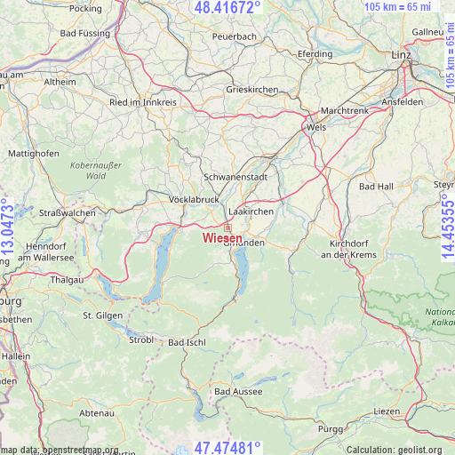
Wiesen GPS coordinates[2]
47° 56' 52.476" North, 13° 45' 1.512" East
| Map corner | latitude | longitude |
|---|---|---|
| Upper-left | 48.41672°, | 13.0473° |
| Center: | 47.94791°, | 13.75042° |
| Lower-right: | 47.47481°, | 14.45355° |
| Map W x H: | 104.7×104.7 km | = 65.1×65.1mi |
| max Lat: | 48.98333° ⇑37% North |
| Wiesen: | 47.94791° |
| min Lat: | ⇓63% South 46.48841° |
| min Long | Wiesen | max Long |
| 9.57802° | 13.75042° | 17.1° |
| W 29.7%⇐ | ⇒70.3% E |
Elevation
Elevation of Wiesen is 449 m = 1473 ft, and this is 56.5 m = 185 ft below average elevation for this country.
| Max E: |
2140 m = 7021 ft | 50.3% |
| Avg. | 505.5 m = 1658 ft | |
| Wiesen | 449 m = 1473 ft | |
Min E: |
118 m = 387 ft | 49.7% |
See also: Austria elevation on elevation.city.
Geographical zone
Wiesen is located in North temperate zone (between Tropic of Cancer and the Arctic Circle). Distance of this North polar circle is 2069.9 km =1286.2 mi to North.| Distance of | km | miles | from Wiesen |
|---|---|---|---|
| North Pole | 4675.8 | 2905.4 | to North |
| Arctic Circle | 2069.9 | 1286.2 | to North |
| Tropic Cancer | 2725.4 | 1693.5 | to South |
| Equator | 5331.3 | 3312.7 | to South |


Nearby cities:
15 places around Wiesen: (largest is in red/bold)
• Altmünster
5.2 km =3.2 mi,  168°
168°
• Aurach am Hongar
5.8 km =3.6 mi,  274°
274°
• Eck
3.7 km =2.3 mi,  153°
153°
• Gmunden
4.9 km =3 mi,  132°
132°
• Großkufhaus
3.1 km =1.9 mi,  198°
198°
• Gschwandt
7.2 km =4.5 mi,  101°
101°
• Kleinreith
3.4 km =2.1 mi, 103°
• Laakirchen
6.5 km =4 mi,  54°
54°
• Oberstraß
6.9 km =4.3 mi,  334°
334°
• Ohlsdorf
3.4 km =2.1 mi,  64°
64°
• Pinsdorf
2.5 km =1.6 mi,  143°
143°
• Preising
6.1 km =3.8 mi, 328°
• Puchheim
6.3 km =3.9 mi,  336°
336°
• Regau
6.7 km =4.2 mi,  315°
315°
• Rutzenmoos
4.3 km =2.7 mi,  312°
312°
Sources, notices
• [Note1] Compared only with cities in Austria existing in our database
• [Src1] Map data: © OpenStreetMap contributors (CC-BY-SA)
• [Src2] Other city data from geonames.org with taken over terms of usage.
• [Src3] Geographical zone / Annual Mean Temperature by Robert A. Rohde @ Wikipedia
