Obertilliach geodata
Obertilliach (Tyrol) is a seat of a third-order administrative division; located in Austria in Europe/Vienna (GMT+2) time zone. With population of 443 people, there are 2573 cities with bigger population in this country. Compared to other cities in Austria, 95% of cities are located further ↑North; 85.7% of cities are located further →East and 99.6% of cities have lower elevation than Obertilliach. Note1


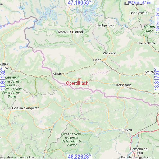
Obertilliach GPS coordinates[2]
46° 42' 38.016" North, 12° 36' 51.984" East
| Map corner | latitude | longitude |
|---|---|---|
| Upper-left | 47.19053°, | 11.91132° |
| Center: | 46.71056°, | 12.61444° |
| Lower-right: | 46.22628°, | 13.31757° |
| Map W x H: | 107.2×107.2 km | = 66.6×66.6mi |
| max Lat: | 48.98333° ⇑95% North |
| Obertilliach: | 46.71056° |
| min Lat: | ⇓5% South 46.48841° |
| min Long | Obertilliach | max Long |
| 9.57802° | 12.61444° | 17.1° |
| W 14.3%⇐ | ⇒85.7% E |
Elevation
Elevation of Obertilliach is 1472 m = 4829 ft, and this is 966.5 m = 3171 ft above average elevation for this country.
| Max E: |
2140 m = 7021 ft | 0.40000000000001% |
| Obertilliach | 1472 m 4829 ft | |
| Avg. | 505.5 m = 1658 ft | |
Min E: |
118 m = 387 ft | 99.6% |
See also: Austria elevation on elevation.city.
Geographical zone
Obertilliach is located in North temperate zone (between Tropic of Cancer and the Arctic Circle). Distance of this North polar circle is 2207.4 km =1371.6 mi to North.| Distance of | km | miles | from Obertilliach |
|---|---|---|---|
| North Pole | 4813.3 | 2990.8 | to North |
| Arctic Circle | 2207.4 | 1371.6 | to North |
| Tropic Cancer | 2587.8 | 1608 | to South |
| Equator | 5193.7 | 3227.2 | to South |


Nearby cities:
15 places around Obertilliach: (largest is in red/bold)
• Abfaltersbach
8.4 km =5.2 mi,  308°
308°
• Amlach
16.4 km =10.2 mi,  43°
43°
• Anras
8.1 km =5 mi,  329°
329°
• Assling
8.7 km =5.4 mi,  12°
12°
• Außervillgraten
16.4 km =10.2 mi,  301°
301°
• Heinfels
13.3 km =8.3 mi,  289°
289°
• Kartitsch
8.9 km =5.5 mi,  283°
283°
• Leisach
15.3 km =9.5 mi, 42°
• Lienz
17.7 km =11 mi, 41°
• Oberlienz
17.6 km =10.9 mi,  30°
30°
• Panzendorf
12.3 km =7.6 mi, 293°
• Sillian
15.5 km =9.6 mi, 287°
• Strassen
11 km =6.8 mi, 295°
• Tristach
17.8 km =11.1 mi,  48°
48°
• Untertilliach
4.9 km =3 mi,  99°
99°
Sources, notices
• [Note1] Compared only with cities in Austria existing in our database
• [Src1] Map data: © OpenStreetMap contributors (CC-BY-SA)
• [Src2] Other city data from geonames.org with taken over terms of usage.
• [Src3] Geographical zone / Annual Mean Temperature by Robert A. Rohde @ Wikipedia
