Nöchling geodata
Nöchling (Lower Austria) is a seat of a third-order administrative division; located in Austria in Europe/Vienna (GMT+2) time zone. With population of 699 people, there are 1858 cities with bigger population in this country. Compared to other cities in Austria, 81% of cities are located further ↓South; 54% of cities are located further ←West and 62.9% of cities have lower elevation than Nöchling. Note1
Administrative division(s):
- Level 1: Lower Austria
- Level 2: Politischer Bezirk Melk
- Level 3: Nöchling


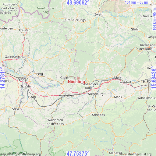
Nöchling GPS coordinates[2]
48° 13' 27.588" North, 14° 58' 52.428" East
| Map corner | latitude | longitude |
|---|---|---|
| Upper-left | 48.69062°, | 14.27811° |
| Center: | 48.22433°, | 14.98123° |
| Lower-right: | 47.75375°, | 15.68436° |
| Map W x H: | 104.2×104.2 km | = 64.7×64.7mi |
| max Lat: | 48.98333° ⇑19% North |
| Nöchling: | 48.22433° |
| min Lat: | ⇓81% South 46.48841° |
| min Long | Nöchling | max Long |
| 9.57802° | 14.98123° | 17.1° |
| W 54%⇐ | ⇒46% E |
Elevation
Elevation of Nöchling is 538 m = 1765 ft, and this is 32.5 m = 107 ft above average elevation for this country.
| Max E: |
2140 m = 7021 ft | 37.1% |
| Nöchling | 538 m 1765 ft | |
| Avg. | 505.5 m = 1658 ft | |
Min E: |
118 m = 387 ft | 62.9% |
See also: Austria elevation on elevation.city.
Geographical zone
Nöchling is located in North temperate zone (between Tropic of Cancer and the Arctic Circle). Distance of this North polar circle is 2039.1 km =1267 mi to North.| Distance of | km | miles | from Nöchling |
|---|---|---|---|
| North Pole | 4645 | 2886.3 | to North |
| Arctic Circle | 2039.1 | 1267 | to North |
| Tropic Cancer | 2756.1 | 1712.6 | to South |
| Equator | 5362 | 3331.8 | to South |


Nearby cities:
15 places around Nöchling: (largest is in red/bold)
• Blindenmarkt
10.8 km =6.7 mi,  177°
177°
• Gottsdorf
10.2 km =6.3 mi,  112°
112°
• Grein
9.1 km =5.7 mi,  273°
273°
• Göttsbach
9 km =5.6 mi,  135°
135°
• Hofamt Priel
7.8 km =4.8 mi, 113°
• Neumarkt an der Ybbs
10.9 km =6.8 mi,  148°
148°
• Neustadtl-Markt
6.8 km =4.2 mi,  239°
239°
• Oed
8.6 km =5.3 mi, 237°
• Persenbeug
8.9 km =5.5 mi,  117°
117°
• Sankt Georgen am Ybbsfelde
10.8 km =6.7 mi,  190°
190°
• Sankt Martin am Ybbsfelde
7.3 km =4.5 mi,  156°
156°
• Viehdorf
10.5 km =6.5 mi,  218°
218°
• Waldhausen im Strudengau
6 km =3.7 mi,  335°
335°
• Ybbs an der Donau
9.9 km =6.2 mi,  130°
130°
• Ysper
9.3 km =5.8 mi,  39°
39°
Sources, notices
• [Note1] Compared only with cities in Austria existing in our database
• [Src1] Map data: © OpenStreetMap contributors (CC-BY-SA)
• [Src2] Other city data from geonames.org with taken over terms of usage.
• [Src3] Geographical zone / Annual Mean Temperature by Robert A. Rohde @ Wikipedia
