Waldhausen im Strudengau geodata
Waldhausen im Strudengau (Upper Austria) is a populated place; located in Austria in Europe/Vienna (GMT+2) time zone. With population of 616 people, there are 2075 cities with bigger population in this country. Compared to other cities in Austria, 84.2% of cities are located further ↓South; 53.6% of cities are located further ←West and 53.4% of cities have lower elevation than Waldhausen im Strudengau. Note1
Administrative division(s):
- Level 1: Upper Austria
- Level 2: Politischer Bezirk Perg
- Level 3: Waldhausen im Strudengau
Current local time in Waldhausen im Strudengau:
11:54 PM, FridayDifference from your time zone: hours


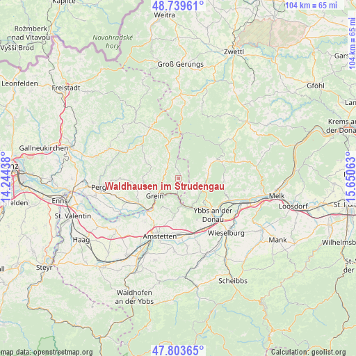
Waldhausen im Strudengau GPS coordinates[2]
48° 16' 25.572" North, 14° 56' 51" East
| Map corner | latitude | longitude |
|---|---|---|
| Upper-left | 48.73961°, | 14.24438° |
| Center: | 48.27377°, | 14.9475° |
| Lower-right: | 47.80365°, | 15.65063° |
| Map W x H: | 104.1×104.1 km | = 64.7×64.7mi |
| max Lat: | 48.98333° ⇑15.8% North |
| Waldhausen im Strudengau: | 48.27377° |
| min Lat: | ⇓84.2% South 46.48841° |
| min Long | Waldhausen im S | max Long |
| 9.57802° | 14.9475° | 17.1° |
| W 53.6%⇐ | ⇒46.4% E |
Elevation
Elevation of Waldhausen im Strudengau is 474 m = 1555 ft, and this is 31.5 m = 103 ft below average elevation for this country.
| Max E: |
2140 m = 7021 ft | 46.6% |
| Avg. | 505.5 m = 1658 ft | |
| Waldhausen im Strudengau | 474 m = 1555 ft | |
Min E: |
118 m = 387 ft | 53.4% |
See also: Austria elevation on elevation.city.
Geographical zone
Waldhausen im Strudengau is located in North temperate zone (between Tropic of Cancer and the Arctic Circle). Distance of this North polar circle is 2033.6 km =1263.6 mi to North.| Distance of | km | miles | from Waldhausen im Strudengau |
|---|---|---|---|
| North Pole | 4639.5 | 2882.9 | to North |
| Arctic Circle | 2033.6 | 1263.6 | to North |
| Tropic Cancer | 2761.6 | 1716 | to South |
| Equator | 5367.5 | 3335.2 | to South |


Nearby cities:
15 places around Waldhausen im Strudengau: (largest is in red/bold)
• Bad Kreuzen
10.5 km =6.5 mi,  266°
266°
• Bärnkopf
13.6 km =8.5 mi,  18°
18°
• Dorfstetten
6.3 km =3.9 mi, 23°
• Grein
8.3 km =5.2 mi,  232°
232°
• Hofamt Priel
13 km =8.1 mi,  132°
132°
• Kollmitzberg
13.9 km =8.6 mi,  211°
211°
• Laimbach am Ostrong
13.4 km =8.3 mi,  69°
69°
• Neustadtl-Markt
9.6 km =6 mi,  200°
200°
• Nöchling
6 km =3.7 mi,  155°
155°
• Oed
11.1 km =6.9 mi, 205°
• Pabneukirchen
11.1 km =6.9 mi,  299°
299°
• Sankt Georgen am Walde
10.1 km =6.3 mi,  340°
340°
• Sankt Martin am Ybbsfelde
13.3 km =8.3 mi, 155°
• Saxen
13.7 km =8.5 mi,  237°
237°
• Ysper
8.6 km =5.3 mi,  78°
78°
In other languages:
- In Russian: Вальдхаузен (Штруденгау), Вальдхаузен-им-Штруденгау
- In Chinese: 施特鲁登高地区瓦尔德豪森
Sources, notices
• [Note1] Compared only with cities in Austria existing in our database
• [Src1] Map data: © OpenStreetMap contributors (CC-BY-SA)
• [Src2] Other city data from geonames.org with taken over terms of usage.
• [Src3] Geographical zone / Annual Mean Temperature by Robert A. Rohde @ Wikipedia
