Grein geodata
Grein (Upper Austria) is a populated place; located in Austria in Europe/Vienna (GMT+2) time zone. With population of 2,068 people, there are 590 cities with bigger population in this country. Compared to other cities in Austria, 81.4% of cities are located further ↓South; 52.7% of cities are located further ←West and 86.9% of cities have higher elevation than Grein. Note1


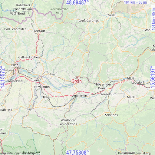
Grein GPS coordinates[2]
48° 13' 43.032" North, 14° 51' 31.824" East
| Map corner | latitude | longitude |
|---|---|---|
| Upper-left | 48.69487°, | 14.15572° |
| Center: | 48.22862°, | 14.85884° |
| Lower-right: | 47.75808°, | 15.56197° |
| Map W x H: | 104.2×104.2 km | = 64.7×64.7mi |
| max Lat: | 48.98333° ⇑18.6% North |
| Grein: | 48.22862° |
| min Lat: | ⇓81.4% South 46.48841° |
| min Long | Grein | max Long |
| 9.57802° | 14.85884° | 17.1° |
| W 52.7%⇐ | ⇒47.3% E |
Elevation
Elevation of Grein is 236 m = 774 ft, and this is 269.5 m = 884 ft below average elevation for this country.
| Max E: |
2140 m = 7021 ft | 86.9% |
| Avg. | 505.5 m = 1658 ft | |
| Grein | 236 m = 774 ft | |
Min E: |
118 m = 387 ft | 13.1% |
See also: Austria elevation on elevation.city.
Geographical zone
Grein is located in North temperate zone (between Tropic of Cancer and the Arctic Circle). Distance of this North polar circle is 2038.7 km =1266.8 mi to North.| Distance of | km | miles | from Grein |
|---|---|---|---|
| North Pole | 4644.5 | 2886 | to North |
| Arctic Circle | 2038.7 | 1266.8 | to North |
| Tropic Cancer | 2756.6 | 1712.9 | to South |
| Equator | 5362.5 | 3332.1 | to South |


Nearby cities:
15 places around Grein: (largest is in red/bold)
• Arbing
11.5 km =7.1 mi,  270°
270°
• Ardagger Markt
7.6 km =4.7 mi,  204°
204°
• Ardagger Stift
8.9 km =5.5 mi,  192°
192°
• Bad Kreuzen
5.8 km =3.6 mi,  318°
318°
• Baumgartenberg
8.8 km =5.5 mi,  255°
255°
• Kollmitzberg
6.9 km =4.3 mi, 185°
• Neustadtl-Markt
5.1 km =3.2 mi,  141°
141°
• Nöchling
9.1 km =5.7 mi,  93°
93°
• Oed
5.4 km =3.4 mi,  160°
160°
• Pabneukirchen
11 km =6.8 mi,  343°
343°
• Saxen
5.5 km =3.4 mi,  245°
245°
• Stephanshart
9.3 km =5.8 mi, 199°
• Viehdorf
9 km =5.6 mi, 163°
• Waldhausen im Strudengau
8.3 km =5.2 mi,  52°
52°
• Zeillern
11.6 km =7.2 mi, 199°
Sources, notices
• [Note1] Compared only with cities in Austria existing in our database
• [Src1] Map data: © OpenStreetMap contributors (CC-BY-SA)
• [Src2] Other city data from geonames.org with taken over terms of usage.
• [Src3] Geographical zone / Annual Mean Temperature by Robert A. Rohde @ Wikipedia
