Ysper geodata
Ysper (Lower Austria) is a populated place; located in Austria in Europe/Vienna (GMT+2) time zone. With population of 1,149 people, there are 1101 cities with bigger population in this country. Compared to other cities in Austria, 85.3% of cities are located further ↓South; 55% of cities are located further ←West and 56.8% of cities have lower elevation than Ysper. Note1
Administrative division(s):
- Level 1: Lower Austria
- Level 2: Politischer Bezirk Melk
- Level 3: Yspertal


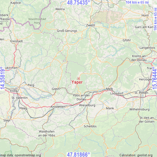
Ysper GPS coordinates[2]
48° 17' 19.14" North, 15° 3' 40.716" East
| Map corner | latitude | longitude |
|---|---|---|
| Upper-left | 48.75435°, | 14.35819° |
| Center: | 48.28865°, | 15.06131° |
| Lower-right: | 47.81866°, | 15.76444° |
| Map W x H: | 104×104 km | = 64.6×64.6mi |
| max Lat: | 48.98333° ⇑14.7% North |
| Ysper: | 48.28865° |
| min Lat: | ⇓85.3% South 46.48841° |
| min Long | Ysper | max Long |
| 9.57802° | 15.06131° | 17.1° |
| W 55%⇐ | ⇒45% E |
Elevation
Elevation of Ysper is 497 m = 1631 ft, and this is 8.5 m = 28 ft below average elevation for this country.
| Max E: |
2140 m = 7021 ft | 43.2% |
| Avg. | 505.5 m = 1658 ft | |
| Ysper | 497 m = 1631 ft | |
Min E: |
118 m = 387 ft | 56.8% |
See also: Austria elevation on elevation.city.
Geographical zone
Ysper is located in North temperate zone (between Tropic of Cancer and the Arctic Circle). Distance of this North polar circle is 2032 km =1262.6 mi to North.| Distance of | km | miles | from Ysper |
|---|---|---|---|
| North Pole | 4637.9 | 2881.9 | to North |
| Arctic Circle | 2032 | 1262.6 | to North |
| Tropic Cancer | 2763.3 | 1717 | to South |
| Equator | 5369.2 | 3336.3 | to South |


Nearby cities:
15 places around Ysper: (largest is in red/bold)
• Bärnkopf
12.1 km =7.5 mi,  339°
339°
• Dorfstetten
7.2 km =4.5 mi,  305°
305°
• Gottsdorf
11.5 km =7.1 mi,  162°
162°
• Gutenbrunn
9.5 km =5.9 mi,  26°
26°
• Hofamt Priel
10.4 km =6.5 mi,  173°
173°
• Krummnußbaum an der Donauuferbahn
11.2 km =7 mi,  136°
136°
• Krumnussbaum
11.6 km =7.2 mi, 139°
• Laimbach am Ostrong
5.1 km =3.2 mi,  52°
52°
• Marbach an der Donau
10.4 km =6.5 mi, 140°
• Maria Taferl
10 km =6.2 mi,  133°
133°
• Martinsberg
11.7 km =7.3 mi, 34°
• Nöchling
9.3 km =5.8 mi,  219°
219°
• Persenbeug
11.4 km =7.1 mi, 170°
• Pöggstall
11 km =6.8 mi,  73°
73°
• Waldhausen im Strudengau
8.6 km =5.3 mi,  258°
258°
Sources, notices
• [Note1] Compared only with cities in Austria existing in our database
• [Src1] Map data: © OpenStreetMap contributors (CC-BY-SA)
• [Src2] Other city data from geonames.org with taken over terms of usage.
• [Src3] Geographical zone / Annual Mean Temperature by Robert A. Rohde @ Wikipedia
