Nikolsdorf geodata
Nikolsdorf (Tyrol) is a seat of a third-order administrative division; located in Austria in Europe/Vienna (GMT+2) time zone. With population of 598 people, there are 2149 cities with bigger population in this country. Compared to other cities in Austria, 92.3% of cities are located further ↑North; 83.8% of cities are located further →East and 83.3% of cities have lower elevation than Nikolsdorf. Note1


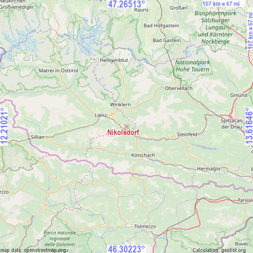
Nikolsdorf GPS coordinates[2]
46° 47' 8.988" North, 12° 54' 47.988" East
| Map corner | latitude | longitude |
|---|---|---|
| Upper-left | 47.26513°, | 12.21021° |
| Center: | 46.78583°, | 12.91333° |
| Lower-right: | 46.30223°, | 13.61646° |
| Map W x H: | 107.1×107.1 km | = 66.5×66.5mi |
| max Lat: | 48.98333° ⇑92.3% North |
| Nikolsdorf: | 46.78583° |
| min Lat: | ⇓7.7% South 46.48841° |
| min Long | Nikolsdorf | max Long |
| 9.57802° | 12.91333° | 17.1° |
| W 16.2%⇐ | ⇒83.8% E |
Elevation
Elevation of Nikolsdorf is 770 m = 2526 ft, and this is 264.5 m = 868 ft above average elevation for this country.
| Max E: |
2140 m = 7021 ft | 16.7% |
| Nikolsdorf | 770 m 2526 ft | |
| Avg. | 505.5 m = 1658 ft | |
Min E: |
118 m = 387 ft | 83.3% |
See also: Austria elevation on elevation.city.
Geographical zone
Nikolsdorf is located in North temperate zone (between Tropic of Cancer and the Arctic Circle). Distance of this North polar circle is 2199.1 km =1366.5 mi to North.| Distance of | km | miles | from Nikolsdorf |
|---|---|---|---|
| North Pole | 4805 | 2985.7 | to North |
| Arctic Circle | 2199.1 | 1366.5 | to North |
| Tropic Cancer | 2596.2 | 1613.2 | to South |
| Equator | 5202.1 | 3232.4 | to South |


Nearby cities:
15 places around Nikolsdorf: (largest is in red/bold)
• Amlach
11.9 km =7.4 mi,  286°
286°
• Debant
9.1 km =5.7 mi,  305°
305°
• Dellach im Drautal
13.7 km =8.5 mi,  113°
113°
• Dölsach
7 km =4.3 mi, 312°
• Irschen
9.1 km =5.7 mi, 110°
• Kötschach
13.6 km =8.5 mi,  148°
148°
• Lavant
5.9 km =3.7 mi,  284°
284°
• Leisach
12.9 km =8 mi, 283°
• Lienz
12 km =7.5 mi, 293°
• Nußdorf
10.1 km =6.3 mi,  301°
301°
• Oberdrauburg
6.4 km =4 mi,  137°
137°
• Rangersdorf
8.7 km =5.4 mi,  18°
18°
• Thurn
13.2 km =8.2 mi, 303°
• Tristach
10 km =6.2 mi, 289°
• Winklern
10.2 km =6.3 mi,  343°
343°
Sources, notices
• [Note1] Compared only with cities in Austria existing in our database
• [Src1] Map data: © OpenStreetMap contributors (CC-BY-SA)
• [Src2] Other city data from geonames.org with taken over terms of usage.
• [Src3] Geographical zone / Annual Mean Temperature by Robert A. Rohde @ Wikipedia
