Rangersdorf geodata
Rangersdorf (Carinthia) is a seat of a third-order administrative division; located in Austria in Europe/Vienna (GMT+2) time zone. With population of 387 people, there are 2635 cities with bigger population in this country. Compared to other cities in Austria, 89.3% of cities are located further ↑North; 83.6% of cities are located further →East and 89.1% of cities have lower elevation than Rangersdorf. Note1
Administrative division(s):
- Level 1: Carinthia
- Level 2: Politischer Bezirk Spittal an der Drau
- Level 3: Rangersdorf


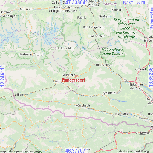
Rangersdorf GPS coordinates[2]
46° 51' 36.036" North, 12° 56' 57.228" East
| Map corner | latitude | longitude |
|---|---|---|
| Upper-left | 47.33864°, | 12.24611° |
| Center: | 46.86001°, | 12.94923° |
| Lower-right: | 46.37707°, | 13.65236° |
| Map W x H: | 106.9×106.9 km | = 66.4×66.4mi |
| max Lat: | 48.98333° ⇑89.3% North |
| Rangersdorf: | 46.86001° |
| min Lat: | ⇓10.7% South 46.48841° |
| min Long | Rangersdorf | max Long |
| 9.57802° | 12.94923° | 17.1° |
| W 16.4%⇐ | ⇒83.6% E |
Elevation
Elevation of Rangersdorf is 860 m = 2822 ft, and this is 354.5 m = 1163 ft above average elevation for this country.
| Max E: |
2140 m = 7021 ft | 10.9% |
| Rangersdorf | 860 m 2822 ft | |
| Avg. | 505.5 m = 1658 ft | |
Min E: |
118 m = 387 ft | 89.1% |
See also: Austria elevation on elevation.city.
Geographical zone
Rangersdorf is located in North temperate zone (between Tropic of Cancer and the Arctic Circle). Distance of this North polar circle is 2190.8 km =1361.3 mi to North.| Distance of | km | miles | from Rangersdorf |
|---|---|---|---|
| North Pole | 4796.7 | 2980.5 | to North |
| Arctic Circle | 2190.8 | 1361.3 | to North |
| Tropic Cancer | 2604.4 | 1618.3 | to South |
| Equator | 5210.3 | 3237.5 | to South |


Nearby cities:
15 places around Rangersdorf: (largest is in red/bold)
• Amlach
14.9 km =9.3 mi,  251°
251°
• Debant
10.5 km =6.5 mi, 253°
• Dölsach
8.7 km =5.4 mi, 245°
• Großkirchheim
13.2 km =8.2 mi,  342°
342°
• Irschen
12.8 km =8 mi,  153°
153°
• Lavant
10.8 km =6.7 mi,  231°
231°
• Lienz
14.1 km =8.8 mi,  255°
255°
• Mörtschach
7.5 km =4.7 mi, 341°
• Nikolsdorf
8.7 km =5.4 mi,  198°
198°
• Nußdorf
11.7 km =7.3 mi, 255°
• Oberdrauburg
13.1 km =8.1 mi,  172°
172°
• Stall
7.5 km =4.7 mi,  62°
62°
• Thurn
13.8 km =8.6 mi,  265°
265°
• Tristach
13.1 km =8.1 mi, 248°
• Winklern
5.9 km =3.7 mi,  284°
284°
Sources, notices
• [Note1] Compared only with cities in Austria existing in our database
• [Src1] Map data: © OpenStreetMap contributors (CC-BY-SA)
• [Src2] Other city data from geonames.org with taken over terms of usage.
• [Src3] Geographical zone / Annual Mean Temperature by Robert A. Rohde @ Wikipedia
