Auffach geodata
Auffach (Tyrol) is a populated place; located in Austria in Europe/Vienna (GMT+2) time zone. With population of 992 people, there are 1306 cities with bigger population in this country. Compared to other cities in Austria, 59.8% of cities are located further ↑North; 88.6% of cities are located further →East and 93.2% of cities have lower elevation than Auffach. Note1
Administrative division(s):
- Level 1: Tyrol
- Level 2: Politischer Bezirk Kufstein
- Level 3: Wildschönau


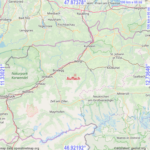
Auffach GPS coordinates[2]
47° 24' 0" North, 12° 1' 59.988" East
| Map corner | latitude | longitude |
|---|---|---|
| Upper-left | 47.87378°, | 11.33021° |
| Center: | 47.4°, | 12.03333° |
| Lower-right: | 46.92192°, | 12.73646° |
| Map W x H: | 105.8×105.8 km | = 65.7×65.7mi |
| max Lat: | 48.98333° ⇑59.8% North |
| Auffach: | 47.4° |
| min Lat: | ⇓40.2% South 46.48841° |
| min Long | Auffach | max Long |
| 9.57802° | 12.03333° | 17.1° |
| W 11.4%⇐ | ⇒88.6% E |
Elevation
Elevation of Auffach is 968 m = 3176 ft, and this is 462.5 m = 1517 ft above average elevation for this country.
| Max E: |
2140 m = 7021 ft | 6.8% |
| Auffach | 968 m 3176 ft | |
| Avg. | 505.5 m = 1658 ft | |
Min E: |
118 m = 387 ft | 93.2% |
See also: Austria elevation on elevation.city.
Geographical zone
Auffach is located in North temperate zone (between Tropic of Cancer and the Arctic Circle). Distance of this North polar circle is 2130.8 km =1324 mi to North.| Distance of | km | miles | from Auffach |
|---|---|---|---|
| North Pole | 4736.7 | 2943.2 | to North |
| Arctic Circle | 2130.8 | 1324 | to North |
| Tropic Cancer | 2664.5 | 1655.6 | to South |
| Equator | 5270.4 | 3274.9 | to South |


Nearby cities:
15 places around Auffach: (largest is in red/bold)
• Alpbach
6.7 km =4.2 mi,  268°
268°
• Breitenbach am Inn
9.8 km =6.1 mi,  332°
332°
• Grafenweg
7.9 km =4.9 mi,  45°
45°
• Hopfgarten im Brixental
10.8 km =6.7 mi,  59°
59°
• Itter
10.6 km =6.6 mi, 45°
• Kelchsau
7.8 km =4.8 mi,  103°
103°
• Kleinsöll
10 km =6.2 mi,  341°
341°
• Kundl
8.3 km =5.2 mi, 333°
• Liesfeld
8.9 km =5.5 mi, 342°
• Niederau
6.7 km =4.2 mi,  34°
34°
• Oberau
5 km =3.1 mi,  13°
13°
• Penningberg
7.3 km =4.5 mi,  70°
70°
• Radfeld
10.4 km =6.5 mi,  300°
300°
• Wildschönau
0.8 km =0.5 mi, 26°
• Wörgl
10.1 km =6.3 mi, 12°
Sources, notices
• [Note1] Compared only with cities in Austria existing in our database
• [Src1] Map data: © OpenStreetMap contributors (CC-BY-SA)
• [Src2] Other city data from geonames.org with taken over terms of usage.
• [Src3] Geographical zone / Annual Mean Temperature by Robert A. Rohde @ Wikipedia
