Angerberg geodata
Angerberg (Tyrol) is a populated place; located in Austria in Europe/Vienna (GMT+2) time zone. With population of 1,225 people, there are 1031 cities with bigger population in this country. Compared to other cities in Austria, 53.4% of cities are located further ↑North; 88.6% of cities are located further →East and 75.6% of cities have lower elevation than Angerberg. Note1


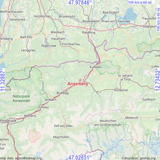
Angerberg GPS coordinates[2]
47° 30' 20.268" North, 12° 1' 52.284" East
| Map corner | latitude | longitude |
|---|---|---|
| Upper-left | 47.97846°, | 11.32807° |
| Center: | 47.50563°, | 12.03119° |
| Lower-right: | 47.02851°, | 12.73432° |
| Map W x H: | 105.6×105.6 km | = 65.6×65.6mi |
| max Lat: | 48.98333° ⇑53.4% North |
| Angerberg: | 47.50563° |
| min Lat: | ⇓46.6% South 46.48841° |
| min Long | Angerberg | max Long |
| 9.57802° | 12.03119° | 17.1° |
| W 11.4%⇐ | ⇒88.6% E |
Elevation
Elevation of Angerberg is 658 m = 2159 ft, and this is 152.5 m = 500 ft above average elevation for this country.
| Max E: |
2140 m = 7021 ft | 24.4% |
| Angerberg | 658 m 2159 ft | |
| Avg. | 505.5 m = 1658 ft | |
Min E: |
118 m = 387 ft | 75.6% |
See also: Austria elevation on elevation.city.
Geographical zone
Angerberg is located in North temperate zone (between Tropic of Cancer and the Arctic Circle). Distance of this North polar circle is 2119 km =1316.7 mi to North.| Distance of | km | miles | from Angerberg |
|---|---|---|---|
| North Pole | 4724.9 | 2935.9 | to North |
| Arctic Circle | 2119 | 1316.7 | to North |
| Tropic Cancer | 2676.2 | 1662.9 | to South |
| Equator | 5282.1 | 3282.1 | to South |


Nearby cities:
15 places around Angerberg: (largest is in red/bold)
• Angath
2.6 km =1.6 mi,  85°
85°
• Bad Häring
6.6 km =4.1 mi, 85°
• Breitenbach am Inn
5.3 km =3.3 mi,  234°
234°
• Kirchbichl
5.1 km =3.2 mi,  74°
74°
• Kleinsöll
3.7 km =2.3 mi, 232°
• Kundl
5.6 km =3.5 mi,  219°
219°
• Langkampfen
7.1 km =4.4 mi,  47°
47°
• Liesfeld
4.2 km =2.6 mi, 217°
• Mariastein
3 km =1.9 mi,  35°
35°
• Niederau
7.3 km =4.5 mi,  147°
147°
• Niederbreitenbach
5 km =3.1 mi, 51°
• Oberau
7.1 km =4.4 mi,  169°
169°
• Oberlangkampfen
4.7 km =2.9 mi, 67°
• Unterlangkampfen
7.1 km =4.4 mi, 46°
• Wörgl
2.9 km =1.8 mi,  128°
128°
Sources, notices
• [Note1] Compared only with cities in Austria existing in our database
• [Src1] Map data: © OpenStreetMap contributors (CC-BY-SA)
• [Src2] Other city data from geonames.org with taken over terms of usage.
• [Src3] Geographical zone / Annual Mean Temperature by Robert A. Rohde @ Wikipedia
