Neidling geodata
Neidling (Lower Austria) is a seat of a third-order administrative division; located in Austria in Europe/Vienna (GMT+2) time zone. With population of 122 people, there are 2914 cities with bigger population in this country. Compared to other cities in Austria, 82% of cities are located further ↓South; 67% of cities are located further ←West and 73% of cities have higher elevation than Neidling. Note1
Administrative division(s):
- Level 1: Lower Austria
- Level 2: Politischer Bezirk Sankt Pölten
- Level 3: Neidling


Neidling GPS coordinates[2]
48° 14' 24.18" North, 15° 33' 21.276" East
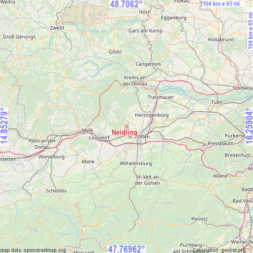
| Map corner | latitude | longitude |
|---|---|---|
| Upper-left | 48.7062°, | 14.85279° |
| Center: | 48.24005°, | 15.55591° |
| Lower-right: | 47.76962°, | 16.25904° |
| Map W x H: | 104.1×104.1 km | = 64.7×64.7mi |
| max Lat: | 48.98333° ⇑18% North |
| Neidling: | 48.24005° |
| min Lat: | ⇓82% South 46.48841° |
| min Long | Neidling | max Long |
| 9.57802° | 15.55591° | 17.1° |
| W 67%⇐ | ⇒33% E |
Elevation
Elevation of Neidling is 313 m = 1027 ft, and this is 192.5 m = 632 ft below average elevation for this country.
| Max E: |
2140 m = 7021 ft | 73% |
| Avg. | 505.5 m = 1658 ft | |
| Neidling | 313 m = 1027 ft | |
Min E: |
118 m = 387 ft | 27% |
See also: Austria elevation on elevation.city.
Geographical zone
Neidling is located in North temperate zone (between Tropic of Cancer and the Arctic Circle). Distance of this North polar circle is 2037.4 km =1266 mi to North.| Distance of | km | miles | from Neidling |
|---|---|---|---|
| North Pole | 4643.3 | 2885.2 | to North |
| Arctic Circle | 2037.4 | 1266 | to North |
| Tropic Cancer | 2757.9 | 1713.7 | to South |
| Equator | 5363.8 | 3332.9 | to South |


Nearby cities:
15 places around Neidling: (largest is in red/bold)
• Gerersdorf
4.4 km =2.7 mi,  179°
179°
• Groß Sierning
8.9 km =5.5 mi,  234°
234°
• Hafnerbach
6 km =3.7 mi,  244°
244°
• Karlstetten
2.2 km =1.4 mi,  18°
18°
• Markersdorf an der Pielach
7.5 km =4.7 mi,  213°
213°
• Oberwagram
8.1 km =5 mi,  121°
121°
• Oberwölbling
9 km =5.6 mi, 17°
• Prinzersdorf
5.3 km =3.3 mi, 213°
• Ragelsdorf
5.9 km =3.7 mi,  89°
89°
• Ratzersdorf an der Traisen
8.3 km =5.2 mi,  100°
100°
• Sankt Pölten
7.3 km =4.5 mi,  127°
127°
• Stattersdorf
8.5 km =5.3 mi,  137°
137°
• Teufelhof
7.7 km =4.8 mi, 144°
• Unterwagram
7.6 km =4.7 mi,  113°
113°
• Viehofen
5.2 km =3.2 mi, 120°
Sources, notices
• [Note1] Compared only with cities in Austria existing in our database
• [Src1] Map data: © OpenStreetMap contributors (CC-BY-SA)
• [Src2] Other city data from geonames.org with taken over terms of usage.
• [Src3] Geographical zone / Annual Mean Temperature by Robert A. Rohde @ Wikipedia
