Hafnerbach geodata
Hafnerbach (Lower Austria) is a seat of a third-order administrative division; located in Austria in Europe/Vienna (GMT+2) time zone. With population of 452 people, there are 2562 cities with bigger population in this country. Compared to other cities in Austria, 80.4% of cities are located further ↓South; 64.9% of cities are located further ←West and 80.2% of cities have higher elevation than Hafnerbach. Note1
Administrative division(s):
- Level 1: Lower Austria
- Level 2: Politischer Bezirk Sankt Pölten
- Level 3: Hafnerbach


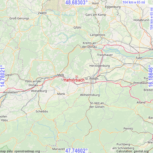
Hafnerbach GPS coordinates[2]
48° 13' 0.012" North, 15° 28' 59.988" East
| Map corner | latitude | longitude |
|---|---|---|
| Upper-left | 48.68303°, | 14.78021° |
| Center: | 48.21667°, | 15.48333° |
| Lower-right: | 47.74602°, | 16.18646° |
| Map W x H: | 104.2×104.2 km | = 64.7×64.7mi |
| max Lat: | 48.98333° ⇑19.6% North |
| Hafnerbach: | 48.21667° |
| min Lat: | ⇓80.4% South 46.48841° |
| min Long | Hafnerbach | max Long |
| 9.57802° | 15.48333° | 17.1° |
| W 64.9%⇐ | ⇒35.1% E |
Elevation
Elevation of Hafnerbach is 274 m = 899 ft, and this is 231.5 m = 760 ft below average elevation for this country.
| Max E: |
2140 m = 7021 ft | 80.2% |
| Avg. | 505.5 m = 1658 ft | |
| Hafnerbach | 274 m = 899 ft | |
Min E: |
118 m = 387 ft | 19.8% |
See also: Austria elevation on elevation.city.
Geographical zone
Hafnerbach is located in North temperate zone (between Tropic of Cancer and the Arctic Circle). Distance of this North polar circle is 2040 km =1267.6 mi to North.| Distance of | km | miles | from Hafnerbach |
|---|---|---|---|
| North Pole | 4645.9 | 2886.8 | to North |
| Arctic Circle | 2040 | 1267.6 | to North |
| Tropic Cancer | 2755.3 | 1712.1 | to South |
| Equator | 5361.2 | 3331.3 | to South |


Nearby cities:
15 places around Hafnerbach: (largest is in red/bold)
• Gansbach
9.9 km =6.2 mi,  355°
355°
• Gerersdorf
5.7 km =3.5 mi,  108°
108°
• Gerolding
6.2 km =3.9 mi,  306°
306°
• Groß Sierning
3.2 km =2 mi,  214°
214°
• Haunoldstein
3.1 km =1.9 mi,  233°
233°
• Hürm
8.5 km =5.3 mi,  217°
217°
• Karlstetten
7.7 km =4.8 mi,  52°
52°
• Loosdorf
6.4 km =4 mi,  253°
253°
• Markersdorf an der Pielach
3.9 km =2.4 mi,  161°
161°
• Mauer bei Melk
5.1 km =3.2 mi,  282°
282°
• Neidling
6 km =3.7 mi,  64°
64°
• Ober-Grafendorf
8.7 km =5.4 mi,  148°
148°
• Prinzersdorf
3.1 km =1.9 mi,  126°
126°
• Sankt Margarethen an der Sierning
6.4 km =4 mi,  175°
175°
• Viehofen
9.9 km =6.2 mi,  90°
90°
Sources, notices
• [Note1] Compared only with cities in Austria existing in our database
• [Src1] Map data: © OpenStreetMap contributors (CC-BY-SA)
• [Src2] Other city data from geonames.org with taken over terms of usage.
• [Src3] Geographical zone / Annual Mean Temperature by Robert A. Rohde @ Wikipedia
