Oberwölbling geodata
Oberwölbling (Lower Austria) is a populated place; located in Austria in Europe/Vienna (GMT+2) time zone. With population of 1,151 people, there are 1098 cities with bigger population in this country. Compared to other cities in Austria, 86.7% of cities are located further ↓South; 68.4% of cities are located further ←West and 70.8% of cities have higher elevation than Oberwölbling. Note1
Administrative division(s):
- Level 1: Lower Austria
- Level 2: Politischer Bezirk Sankt Pölten
- Level 3: Wölbling


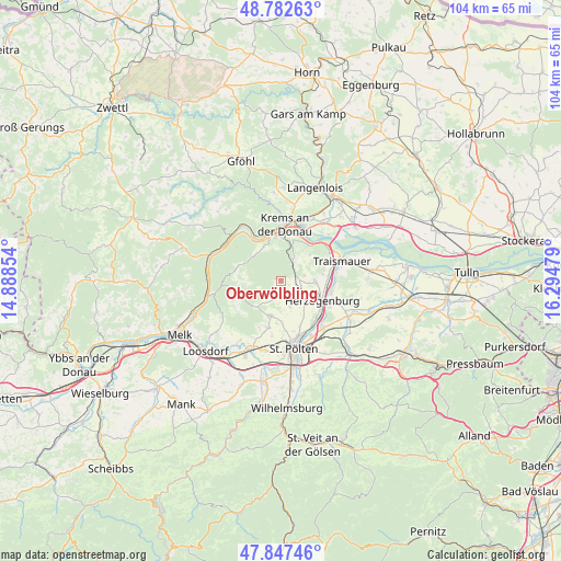
Oberwölbling GPS coordinates[2]
48° 19' 1.884" North, 15° 35' 29.976" East
| Map corner | latitude | longitude |
|---|---|---|
| Upper-left | 48.78263°, | 14.88854° |
| Center: | 48.31719°, | 15.59166° |
| Lower-right: | 47.84746°, | 16.29479° |
| Map W x H: | 104×104 km | = 64.6×64.6mi |
| max Lat: | 48.98333° ⇑13.3% North |
| Oberwölbling: | 48.31719° |
| min Lat: | ⇓86.7% South 46.48841° |
| min Long | Oberwölbling | max Long |
| 9.57802° | 15.59166° | 17.1° |
| W 68.4%⇐ | ⇒31.6% E |
Elevation
Elevation of Oberwölbling is 324 m = 1063 ft, and this is 181.5 m = 595 ft below average elevation for this country.
| Max E: |
2140 m = 7021 ft | 70.8% |
| Avg. | 505.5 m = 1658 ft | |
| Oberwölbling | 324 m = 1063 ft | |
Min E: |
118 m = 387 ft | 29.2% |
See also: Austria elevation on elevation.city.
Geographical zone
Oberwölbling is located in North temperate zone (between Tropic of Cancer and the Arctic Circle). Distance of this North polar circle is 2028.8 km =1260.6 mi to North.| Distance of | km | miles | from Oberwölbling |
|---|---|---|---|
| North Pole | 4634.7 | 2879.9 | to North |
| Arctic Circle | 2028.8 | 1260.6 | to North |
| Tropic Cancer | 2766.4 | 1719 | to South |
| Equator | 5372.4 | 3338.3 | to South |


Nearby cities:
15 places around Oberwölbling: (largest is in red/bold)
• Furth bei Göttweig
6.5 km =4 mi,  14°
14°
• Gansbach
8.9 km =5.5 mi,  261°
261°
• Getzersdorf
7.8 km =4.8 mi,  80°
80°
• Herzogenburg
8.6 km =5.3 mi,  117°
117°
• Inzersdorf ob der Traisen
5.2 km =3.2 mi,  91°
91°
• Karlstetten
6.7 km =4.2 mi,  196°
196°
• Mautern
8.5 km =5.3 mi,  353°
353°
• Neidling
9 km =5.6 mi, 197°
• Nussdorf ob der Traisen
8.7 km =5.4 mi,  62°
62°
• Oberndorf in der Ebene
8.9 km =5.5 mi,  125°
125°
• Palt
7.7 km =4.8 mi, 12°
• Paudorf
4.6 km =2.9 mi,  25°
25°
• Reichersdorf
8.2 km =5.1 mi,  73°
73°
• Statzendorf
3.8 km =2.4 mi,  106°
106°
• Unterbergern
6.3 km =3.9 mi,  330°
330°
Sources, notices
• [Note1] Compared only with cities in Austria existing in our database
• [Src1] Map data: © OpenStreetMap contributors (CC-BY-SA)
• [Src2] Other city data from geonames.org with taken over terms of usage.
• [Src3] Geographical zone / Annual Mean Temperature by Robert A. Rohde @ Wikipedia
