Karlstetten geodata
Karlstetten (Lower Austria) is a seat of a third-order administrative division; located in Austria in Europe/Vienna (GMT+2) time zone. With population of 1,353 people, there are 935 cities with bigger population in this country. Compared to other cities in Austria, 83.4% of cities are located further ↓South; 67.2% of cities are located further ←West and 61.6% of cities have higher elevation than Karlstetten. Note1
Administrative division(s):
- Level 1: Lower Austria
- Level 2: Politischer Bezirk Sankt Pölten
- Level 3: Karlstetten


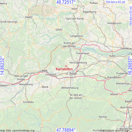
Karlstetten GPS coordinates[2]
48° 15' 33.12" North, 15° 33' 55.584" East
| Map corner | latitude | longitude |
|---|---|---|
| Upper-left | 48.72517°, | 14.86232° |
| Center: | 48.2592°, | 15.56544° |
| Lower-right: | 47.78894°, | 16.26857° |
| Map W x H: | 104.1×104.1 km | = 64.7×64.7mi |
| max Lat: | 48.98333° ⇑16.6% North |
| Karlstetten: | 48.2592° |
| min Lat: | ⇓83.4% South 46.48841° |
| min Long | Karlstetten | max Long |
| 9.57802° | 15.56544° | 17.1° |
| W 67.2%⇐ | ⇒32.8% E |
Elevation
Elevation of Karlstetten is 372 m = 1220 ft, and this is 133.5 m = 438 ft below average elevation for this country.
| Max E: |
2140 m = 7021 ft | 61.6% |
| Avg. | 505.5 m = 1658 ft | |
| Karlstetten | 372 m = 1220 ft | |
Min E: |
118 m = 387 ft | 38.4% |
See also: Austria elevation on elevation.city.
Geographical zone
Karlstetten is located in North temperate zone (between Tropic of Cancer and the Arctic Circle). Distance of this North polar circle is 2035.3 km =1264.7 mi to North.| Distance of | km | miles | from Karlstetten |
|---|---|---|---|
| North Pole | 4641.1 | 2883.8 | to North |
| Arctic Circle | 2035.3 | 1264.7 | to North |
| Tropic Cancer | 2760 | 1715 | to South |
| Equator | 5365.9 | 3334.2 | to South |


Nearby cities:
15 places around Karlstetten: (largest is in red/bold)
• Gansbach
8.6 km =5.3 mi,  306°
306°
• Gerersdorf
6.5 km =4 mi,  186°
186°
• Hafnerbach
7.7 km =4.8 mi,  232°
232°
• Neidling
2.2 km =1.4 mi,  198°
198°
• Oberndorf in der Ebene
9.3 km =5.8 mi,  82°
82°
• Oberwagram
8.9 km =5.5 mi,  135°
135°
• Oberwölbling
6.7 km =4.2 mi,  16°
16°
• Prinzersdorf
7.5 km =4.7 mi,  208°
208°
• Ragelsdorf
5.6 km =3.5 mi,  111°
111°
• Ratzersdorf an der Traisen
8.3 km =5.2 mi,  116°
116°
• Sankt Pölten
8.3 km =5.2 mi, 142°
• Statzendorf
7.8 km =4.8 mi,  46°
46°
• Unterradlberg
8.4 km =5.2 mi,  94°
94°
• Unterwagram
8.1 km =5 mi,  129°
129°
• Viehofen
6.1 km =3.8 mi, 141°
Sources, notices
• [Note1] Compared only with cities in Austria existing in our database
• [Src1] Map data: © OpenStreetMap contributors (CC-BY-SA)
• [Src2] Other city data from geonames.org with taken over terms of usage.
• [Src3] Geographical zone / Annual Mean Temperature by Robert A. Rohde @ Wikipedia
