Moosdorf geodata
Moosdorf (Upper Austria) is a seat of a third-order administrative division; located in Austria in Europe/Vienna (GMT+2) time zone. With population of 445 people, there are 2570 cities with bigger population in this country. Compared to other cities in Austria, 69.2% of cities are located further ↓South; 83.2% of cities are located further →East and 53.6% of cities have lower elevation than Moosdorf. Note1
Administrative division(s):
- Level 1: Upper Austria
- Level 2: Politischer Bezirk Braunau am Inn
- Level 3: Moosdorf


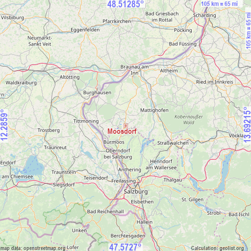
Moosdorf GPS coordinates[2]
48° 2' 41.712" North, 12° 59' 20.472" East
| Map corner | latitude | longitude |
|---|---|---|
| Upper-left | 48.51285°, | 12.2859° |
| Center: | 48.04492°, | 12.98902° |
| Lower-right: | 47.5727°, | 13.69215° |
| Map W x H: | 104.5×104.5 km | = 64.9×64.9mi |
| max Lat: | 48.98333° ⇑30.8% North |
| Moosdorf: | 48.04492° |
| min Lat: | ⇓69.2% South 46.48841° |
| min Long | Moosdorf | max Long |
| 9.57802° | 12.98902° | 17.1° |
| W 16.8%⇐ | ⇒83.2% E |
Elevation
Elevation of Moosdorf is 475 m = 1558 ft, and this is 30.5 m = 100 ft below average elevation for this country.
| Max E: |
2140 m = 7021 ft | 46.4% |
| Avg. | 505.5 m = 1658 ft | |
| Moosdorf | 475 m = 1558 ft | |
Min E: |
118 m = 387 ft | 53.6% |
See also: Austria elevation on elevation.city.
Geographical zone
Moosdorf is located in North temperate zone (between Tropic of Cancer and the Arctic Circle). Distance of this North polar circle is 2059.1 km =1279.5 mi to North.| Distance of | km | miles | from Moosdorf |
|---|---|---|---|
| North Pole | 4665 | 2898.7 | to North |
| Arctic Circle | 2059.1 | 1279.5 | to North |
| Tropic Cancer | 2736.2 | 1700.2 | to South |
| Equator | 5342.1 | 3319.4 | to South |


Nearby cities:
15 places around Moosdorf: (largest is in red/bold)
• Berndorf bei Salzburg
7.7 km =4.8 mi,  135°
135°
• Bürmoos
8.6 km =5.3 mi,  217°
217°
• Dorfbeuern
3.8 km =2.4 mi,  146°
146°
• Eching
11 km =6.8 mi, 223°
• Eggelsberg
3.8 km =2.4 mi,  1°
1°
• Handenberg
10 km =6.2 mi,  7°
7°
• Lamprechtshausen
6.5 km =4 mi,  202°
202°
• Nußdorf am Haunsberg
9.6 km =6 mi,  171°
171°
• Palting
10.8 km =6.7 mi,  107°
107°
• Perwang am Grabensee
8.2 km =5.1 mi,  121°
121°
• Riedersbach
10.7 km =6.6 mi,  257°
257°
• Sankt Georgen am Fillmannsbach
9.1 km =5.7 mi, 8°
• Sankt Pantaleon
8.2 km =5.1 mi,  239°
239°
• Seeham
10.8 km =6.7 mi, 142°
• Wagnergraben
3.8 km =2.4 mi, 136°
Sources, notices
• [Note1] Compared only with cities in Austria existing in our database
• [Src1] Map data: © OpenStreetMap contributors (CC-BY-SA)
• [Src2] Other city data from geonames.org with taken over terms of usage.
• [Src3] Geographical zone / Annual Mean Temperature by Robert A. Rohde @ Wikipedia
