Eggelsberg geodata
Eggelsberg (Upper Austria) is a populated place; located in Austria in Europe/Vienna (GMT+2) time zone. With population of 818 people, there are 1580 cities with bigger population in this country. Compared to other cities in Austria, 71.3% of cities are located further ↓South; 83.2% of cities are located further →East and 60.2% of cities have lower elevation than Eggelsberg. Note1
Administrative division(s):
- Level 1: Upper Austria
- Level 2: Politischer Bezirk Braunau am Inn
- Level 3: Eggelsberg


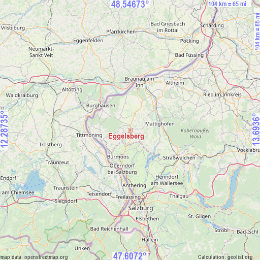
Eggelsberg GPS coordinates[2]
48° 4' 44.796" North, 12° 59' 25.692" East
| Map corner | latitude | longitude |
|---|---|---|
| Upper-left | 48.54673°, | 12.28735° |
| Center: | 48.07911°, | 12.99047° |
| Lower-right: | 47.6072°, | 13.6936° |
| Map W x H: | 104.5×104.5 km | = 64.9×64.9mi |
| max Lat: | 48.98333° ⇑28.7% North |
| Eggelsberg: | 48.07911° |
| min Lat: | ⇓71.3% South 46.48841° |
| min Long | Eggelsberg | max Long |
| 9.57802° | 12.99047° | 17.1° |
| W 16.8%⇐ | ⇒83.2% E |
Elevation
Elevation of Eggelsberg is 518 m = 1699 ft, and this is 12.5 m = 41 ft above average elevation for this country.
| Max E: |
2140 m = 7021 ft | 39.8% |
| Eggelsberg | 518 m 1699 ft | |
| Avg. | 505.5 m = 1658 ft | |
Min E: |
118 m = 387 ft | 60.2% |
See also: Austria elevation on elevation.city.
Geographical zone
Eggelsberg is located in North temperate zone (between Tropic of Cancer and the Arctic Circle). Distance of this North polar circle is 2055.3 km =1277.1 mi to North.| Distance of | km | miles | from Eggelsberg |
|---|---|---|---|
| North Pole | 4661.2 | 2896.3 | to North |
| Arctic Circle | 2055.3 | 1277.1 | to North |
| Tropic Cancer | 2740 | 1702.6 | to South |
| Equator | 5345.9 | 3321.8 | to South |


Nearby cities:
15 places around Eggelsberg: (largest is in red/bold)
• Berndorf bei Salzburg
10.7 km =6.6 mi,  150°
150°
• Bürmoos
11.9 km =7.4 mi,  206°
206°
• Dorfbeuern
7.2 km =4.5 mi,  164°
164°
• Friedrichsdorf
11.6 km =7.2 mi,  24°
24°
• Handenberg
6.2 km =3.9 mi,  11°
11°
• Hochburg-Ach
10.1 km =6.3 mi,  303°
303°
• Lamprechtshausen
10.2 km =6.3 mi,  195°
195°
• Mattighofen
12.3 km =7.6 mi,  75°
75°
• Moosdorf
3.8 km =2.4 mi,  181°
181°
• Perwang am Grabensee
10.6 km =6.6 mi,  139°
139°
• Pfaffstätt
11.4 km =7.1 mi,  91°
91°
• Riedersbach
12.2 km =7.6 mi,  239°
239°
• Sankt Georgen am Fillmannsbach
5.3 km =3.3 mi, 14°
• Sankt Pantaleon
10.7 km =6.6 mi,  222°
222°
• Wagnergraben
7 km =4.3 mi, 159°
Sources, notices
• [Note1] Compared only with cities in Austria existing in our database
• [Src1] Map data: © OpenStreetMap contributors (CC-BY-SA)
• [Src2] Other city data from geonames.org with taken over terms of usage.
• [Src3] Geographical zone / Annual Mean Temperature by Robert A. Rohde @ Wikipedia
