Laab geodata
Laab (Upper Austria) is a section of populated place; located in Austria in Europe/Vienna (GMT+2) time zone. With population of 3,150 people, there are 353 cities with bigger population in this country. Compared to other cities in Austria, 83.5% of cities are located further ↓South; 82.2% of cities are located further →East and 70.3% of cities have higher elevation than Laab. Note1
Administrative division(s):
- Level 1: Upper Austria
- Level 2: Politischer Bezirk Braunau am Inn
- Level 3: Braunau am Inn


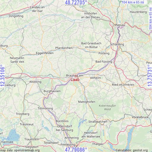
Laab GPS coordinates[2]
48° 15' 39.96" North, 13° 3' 15.048" East
| Map corner | latitude | longitude |
|---|---|---|
| Upper-left | 48.72705°, | 12.35106° |
| Center: | 48.2611°, | 13.05418° |
| Lower-right: | 47.79086°, | 13.75731° |
| Map W x H: | 104.1×104.1 km | = 64.7×64.7mi |
| max Lat: | 48.98333° ⇑16.5% North |
| Laab: | 48.2611° |
| min Lat: | ⇓83.5% South 46.48841° |
| min Long | Laab | max Long |
| 9.57802° | 13.05418° | 17.1° |
| W 17.8%⇐ | ⇒82.2% E |
Elevation
Elevation of Laab is 326 m = 1070 ft, and this is 179.5 m = 589 ft below average elevation for this country.
| Max E: |
2140 m = 7021 ft | 70.3% |
| Avg. | 505.5 m = 1658 ft | |
| Laab | 326 m = 1070 ft | |
Min E: |
118 m = 387 ft | 29.7% |
See also: Austria elevation on elevation.city.
Geographical zone
Laab is located in North temperate zone (between Tropic of Cancer and the Arctic Circle). Distance of this North polar circle is 2035 km =1264.5 mi to North.| Distance of | km | miles | from Laab |
|---|---|---|---|
| North Pole | 4640.9 | 2883.7 | to North |
| Arctic Circle | 2035 | 1264.5 | to North |
| Tropic Cancer | 2760.2 | 1715.1 | to South |
| Equator | 5366.1 | 3334.3 | to South |


Nearby cities:
15 places around Laab: (largest is in red/bold)
• Altheim
13.4 km =8.3 mi,  94°
94°
• Braunau Neustadt
2.2 km =1.4 mi,  219°
219°
• Braunau am Inn
1 km =0.6 mi,  236°
236°
• Burgkirchen
7.2 km =4.5 mi,  151°
151°
• Friedrichsdorf
9.7 km =6 mi,  179°
179°
• Haselbach
0.9 km =0.6 mi,  170°
170°
• Höfen
13.4 km =8.3 mi,  155°
155°
• Mauerkirchen
9.7 km =6 mi,  142°
142°
• Mining
8.1 km =5 mi,  77°
77°
• Neue Heimat
1.9 km =1.2 mi,  208°
208°
• Osternberg
2.6 km =1.6 mi,  227°
227°
• Ranshofen
4.2 km =2.6 mi, 222°
• Sankt Peter am Hart
3.2 km =2 mi,  106°
106°
• Uttendorf
12.4 km =7.7 mi, 156°
• Weng im Innkreis
9.6 km =6 mi, 107°
Sources, notices
• [Note1] Compared only with cities in Austria existing in our database
• [Src1] Map data: © OpenStreetMap contributors (CC-BY-SA)
• [Src2] Other city data from geonames.org with taken over terms of usage.
• [Src3] Geographical zone / Annual Mean Temperature by Robert A. Rohde @ Wikipedia
