Groß-Enzersdorf geodata
Groß-Enzersdorf (Lower Austria) is a seat of a third-order administrative division; located in Austria in Europe/Vienna (GMT+2) time zone. With population of 6,616 people, there are 139 cities with bigger population in this country. Compared to other cities in Austria, 79.5% of cities are located further ↓South; 95% of cities are located further ←West and 97.7% of cities have higher elevation than Groß-Enzersdorf. Note1
Administrative division(s):
- Level 1: Lower Austria
- Level 2: Politischer Bezirk Gänserndorf
- Level 3: Groß-Enzersdorf


Groß-Enzersdorf GPS coordinates[2]
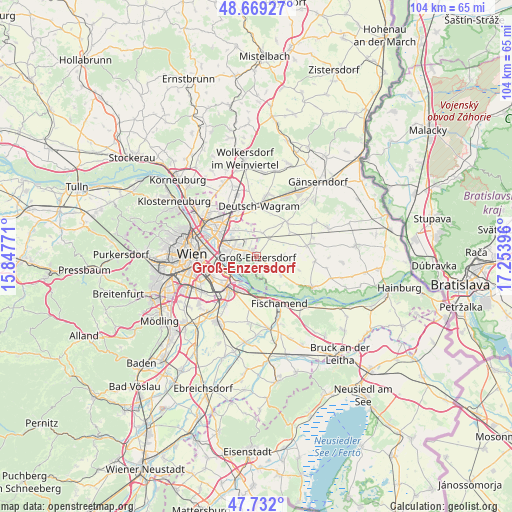
48° 12' 10.008" North, 16° 33' 2.988" East
| Map corner | latitude | longitude |
|---|---|---|
| Upper-left | 48.66927°, | 15.84771° |
| Center: | 48.20278°, | 16.55083° |
| Lower-right: | 47.732°, | 17.25396° |
| Map W x H: | 104.2×104.2 km | = 64.7×64.7mi |
| max Lat: | 48.98333° ⇑20.5% North |
| Groß-Enzersdorf: | 48.20278° |
| min Lat: | ⇓79.5% South 46.48841° |
| min Long | Groß-Enzersdor | max Long |
| 9.57802° | 16.55083° | 17.1° |
| W 95%⇐ | ⇒5% E |
Elevation
Elevation of Groß-Enzersdorf is 157 m = 515 ft, and this is 348.5 m = 1143 ft below average elevation for this country.
| Max E: |
2140 m = 7021 ft | 97.7% |
| Avg. | 505.5 m = 1658 ft | |
| Groß-Enzersdorf | 157 m = 515 ft | |
Min E: |
118 m = 387 ft | 2.3% |
See also: Austria elevation on elevation.city.
Geographical zone
Groß-Enzersdorf is located in North temperate zone (between Tropic of Cancer and the Arctic Circle). Distance of this North polar circle is 2041.5 km =1268.5 mi to North.| Distance of | km | miles | from Groß-Enzersdorf |
|---|---|---|---|
| North Pole | 4647.4 | 2887.8 | to North |
| Arctic Circle | 2041.5 | 1268.5 | to North |
| Tropic Cancer | 2753.7 | 1711.1 | to South |
| Equator | 5359.6 | 3330.3 | to South |


Nearby cities:
15 places around Groß-Enzersdorf: (largest is in red/bold)
• Aderklaa
9 km =5.6 mi,  351°
351°
• Andlersdorf
8.9 km =5.5 mi,  104°
104°
• Donaustadt
7.5 km =4.7 mi,  296°
296°
• Fischamend Dorf
9.8 km =6.1 mi,  157°
157°
• Glinzendorf
8.2 km =5.1 mi,  54°
54°
• Großhofen
8 km =5 mi,  39°
39°
• Mannswörth
6.9 km =4.3 mi,  203°
203°
• Markgrafneusiedl
9.4 km =5.8 mi, 40°
• Oberhausen
3.8 km =2.4 mi,  138°
138°
• Parbasdorf
9.7 km =6 mi,  22°
22°
• Probstdorf
6 km =3.7 mi,  126°
126°
• Raasdorf
5 km =3.1 mi,  12°
12°
• Schwechat
9.9 km =6.2 mi,  218°
218°
• Simmering
9 km =5.6 mi,  256°
256°
• Wittau
4.2 km =2.6 mi,  124°
124°
Sources, notices
• [Note1] Compared only with cities in Austria existing in our database
• [Src1] Map data: © OpenStreetMap contributors (CC-BY-SA)
• [Src2] Other city data from geonames.org with taken over terms of usage.
• [Src3] Geographical zone / Annual Mean Temperature by Robert A. Rohde @ Wikipedia
