Wittau geodata
Wittau (Lower Austria) is a populated place; located in Austria in Europe/Vienna (GMT+2) time zone. With population of 599 people, there are 2144 cities with bigger population in this country. Compared to other cities in Austria, 77.8% of cities are located further ↓South; 95.7% of cities are located further ←West and 98.2% of cities have higher elevation than Wittau. Note1
Administrative division(s):
- Level 1: Lower Austria
- Level 2: Politischer Bezirk Gänserndorf
- Level 3: Groß-Enzersdorf


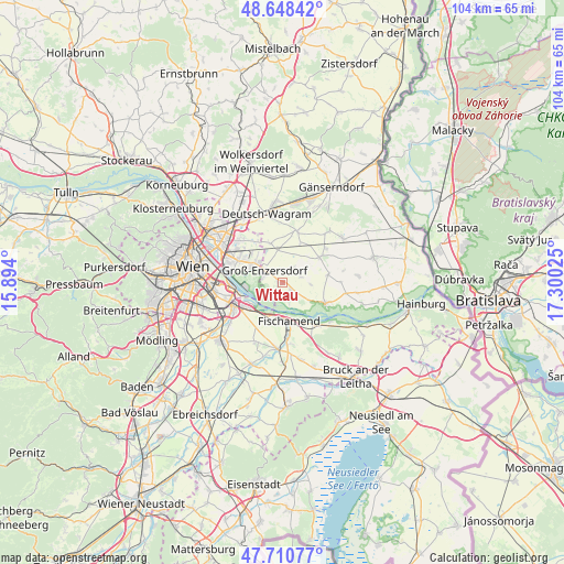
Wittau GPS coordinates[2]
48° 10' 54.264" North, 16° 35' 49.632" East
| Map corner | latitude | longitude |
|---|---|---|
| Upper-left | 48.64842°, | 15.894° |
| Center: | 48.18174°, | 16.59712° |
| Lower-right: | 47.71077°, | 17.30025° |
| Map W x H: | 104.3×104.3 km | = 64.8×64.8mi |
| max Lat: | 48.98333° ⇑22.2% North |
| Wittau: | 48.18174° |
| min Lat: | ⇓77.8% South 46.48841° |
| min Long | Wittau | max Long |
| 9.57802° | 16.59712° | 17.1° |
| W 95.7%⇐ | ⇒4.3% E |
Elevation
Elevation of Wittau is 152 m = 499 ft, and this is 353.5 m = 1160 ft below average elevation for this country.
| Max E: |
2140 m = 7021 ft | 98.2% |
| Avg. | 505.5 m = 1658 ft | |
| Wittau | 152 m = 499 ft | |
Min E: |
118 m = 387 ft | 1.8% |
See also: Austria elevation on elevation.city.
Geographical zone
Wittau is located in North temperate zone (between Tropic of Cancer and the Arctic Circle). Distance of this North polar circle is 2043.9 km =1270 mi to North.| Distance of | km | miles | from Wittau |
|---|---|---|---|
| North Pole | 4649.8 | 2889.3 | to North |
| Arctic Circle | 2043.9 | 1270 | to North |
| Tropic Cancer | 2751.4 | 1709.6 | to South |
| Equator | 5357.3 | 3328.9 | to South |


Nearby cities:
15 places around Wittau: (largest is in red/bold)
• Andlersdorf
5.2 km =3.2 mi,  88°
88°
• Fischamend Dorf
6.7 km =4.2 mi,  177°
177°
• Fischamend-Markt
7.2 km =4.5 mi, 178°
• Glinzendorf
7.8 km =4.8 mi,  24°
24°
• Groß-Enzersdorf
4.2 km =2.6 mi,  304°
304°
• Großhofen
8.7 km =5.4 mi,  10°
10°
• Klein-Neusiedl
9.8 km =6.1 mi, 175°
• Leopoldsdorf im Marchfelde
8.2 km =5.1 mi,  56°
56°
• Mannsdorf an der Donau
6 km =3.7 mi,  123°
123°
• Mannswörth
7.4 km =4.6 mi,  236°
236°
• Markgrafneusiedl
9.8 km =6.1 mi, 15°
• Oberhausen
1 km =0.6 mi, 238°
• Orth an der Donau
8.7 km =5.4 mi, 117°
• Probstdorf
1.9 km =1.2 mi,  130°
130°
• Raasdorf
7.6 km =4.7 mi,  341°
341°
Sources, notices
• [Note1] Compared only with cities in Austria existing in our database
• [Src1] Map data: © OpenStreetMap contributors (CC-BY-SA)
• [Src2] Other city data from geonames.org with taken over terms of usage.
• [Src3] Geographical zone / Annual Mean Temperature by Robert A. Rohde @ Wikipedia
