Lengfelden geodata
Lengfelden (Salzburg) is a populated place; located in Austria in Europe/Vienna (GMT+2) time zone. With population of 1,463 people, there are 860 cities with bigger population in this country. Compared to other cities in Austria, 58.7% of cities are located further ↓South; 82.3% of cities are located further →East and 51.6% of cities have higher elevation than Lengfelden. Note1
Administrative division(s):
- Level 1: Salzburg
- Level 2: Politischer Bezirk Salzburg-Umgebung
- Level 3: Bergheim


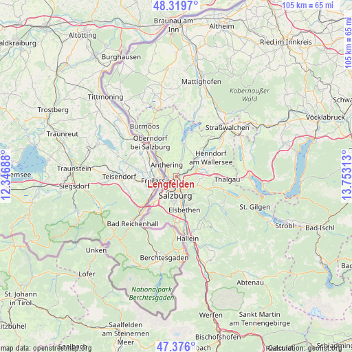
Lengfelden GPS coordinates[2]
47° 51' 0" North, 13° 3' 0" East
| Map corner | latitude | longitude |
|---|---|---|
| Upper-left | 48.3197°, | 12.34688° |
| Center: | 47.85°, | 13.05° |
| Lower-right: | 47.376°, | 13.75313° |
| Map W x H: | 104.9×104.9 km | = 65.2×65.2mi |
| max Lat: | 48.98333° ⇑41.3% North |
| Lengfelden: | 47.85° |
| min Lat: | ⇓58.7% South 46.48841° |
| min Long | Lengfelden | max Long |
| 9.57802° | 13.05° | 17.1° |
| W 17.7%⇐ | ⇒82.3% E |
Elevation
Elevation of Lengfelden is 442 m = 1450 ft, and this is 63.5 m = 208 ft below average elevation for this country.
| Max E: |
2140 m = 7021 ft | 51.6% |
| Avg. | 505.5 m = 1658 ft | |
| Lengfelden | 442 m = 1450 ft | |
Min E: |
118 m = 387 ft | 48.4% |
See also: Austria elevation on elevation.city.
Geographical zone
Lengfelden is located in North temperate zone (between Tropic of Cancer and the Arctic Circle). Distance of this North polar circle is 2080.8 km =1292.9 mi to North.| Distance of | km | miles | from Lengfelden |
|---|---|---|---|
| North Pole | 4686.6 | 2912.1 | to North |
| Arctic Circle | 2080.8 | 1292.9 | to North |
| Tropic Cancer | 2714.5 | 1686.7 | to South |
| Equator | 5320.4 | 3305.9 | to South |


Nearby cities:
15 places around Lengfelden: (largest is in red/bold)
• Anthering
4.5 km =2.8 mi,  326°
326°
• Bergheim
2.2 km =1.4 mi,  213°
213°
• Elixhausen
2.2 km =1.4 mi,  33°
33°
• Esch
3.3 km =2.1 mi,  108°
108°
• Eugenbach
6.5 km =4 mi,  72°
72°
• Eugendorf
6 km =3.7 mi, 70°
• Hallwang
2.5 km =1.6 mi,  90°
90°
• Himmelreich
7.5 km =4.7 mi,  221°
221°
• Lehen
3.4 km =2.1 mi,  313°
313°
• Salzburg
5.6 km =3.5 mi,  184°
184°
• Schwaighofen
6.8 km =4.2 mi, 107°
• Siezenheim
5.9 km =3.7 mi,  229°
229°
• Waldprechting
7.5 km =4.7 mi,  41°
41°
• Wimmsiedlung
7 km =4.3 mi,  50°
50°
• Zilling
3.7 km =2.3 mi, 90°
Sources, notices
• [Note1] Compared only with cities in Austria existing in our database
• [Src1] Map data: © OpenStreetMap contributors (CC-BY-SA)
• [Src2] Other city data from geonames.org with taken over terms of usage.
• [Src3] Geographical zone / Annual Mean Temperature by Robert A. Rohde @ Wikipedia
