Schwaighofen geodata
Schwaighofen (Salzburg) is a populated place; located in Austria in Europe/Vienna (GMT+2) time zone. With population of 662 people, there are 1951 cities with bigger population in this country. Compared to other cities in Austria, 58% of cities are located further ↓South; 80.4% of cities are located further →East and 77.3% of cities have lower elevation than Schwaighofen. Note1
Administrative division(s):
- Level 1: Salzburg
- Level 2: Politischer Bezirk Salzburg-Umgebung
- Level 3: Eugendorf


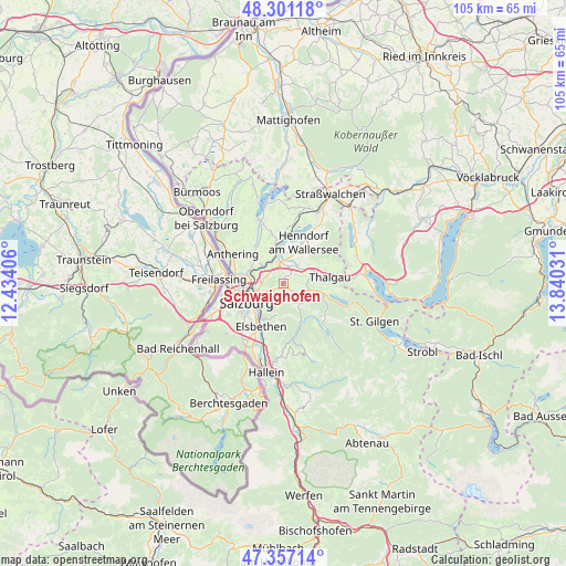
Schwaighofen GPS coordinates[2]
47° 49' 52.716" North, 13° 8' 13.848" East
| Map corner | latitude | longitude |
|---|---|---|
| Upper-left | 48.30118°, | 12.43406° |
| Center: | 47.83131°, | 13.13718° |
| Lower-right: | 47.35714°, | 13.84031° |
| Map W x H: | 105×105 km | = 65.2×65.2mi |
| max Lat: | 48.98333° ⇑42% North |
| Schwaighofen: | 47.83131° |
| min Lat: | ⇓58% South 46.48841° |
| min Long | Schwaighofen | max Long |
| 9.57802° | 13.13718° | 17.1° |
| W 19.6%⇐ | ⇒80.4% E |
Elevation
Elevation of Schwaighofen is 678 m = 2224 ft, and this is 172.5 m = 566 ft above average elevation for this country.
| Max E: |
2140 m = 7021 ft | 22.7% |
| Schwaighofen | 678 m 2224 ft | |
| Avg. | 505.5 m = 1658 ft | |
Min E: |
118 m = 387 ft | 77.3% |
See also: Austria elevation on elevation.city.
Geographical zone
Schwaighofen is located in North temperate zone (between Tropic of Cancer and the Arctic Circle). Distance of this North polar circle is 2082.8 km =1294.2 mi to North.| Distance of | km | miles | from Schwaighofen |
|---|---|---|---|
| North Pole | 4688.7 | 2913.4 | to North |
| Arctic Circle | 2082.8 | 1294.2 | to North |
| Tropic Cancer | 2712.4 | 1685.4 | to South |
| Equator | 5318.3 | 3304.6 | to South |


Nearby cities:
15 places around Schwaighofen: (largest is in red/bold)
• Ebenau
5.3 km =3.3 mi,  147°
147°
• Elixhausen
6.6 km =4.1 mi,  306°
306°
• Enzersberg
5.1 km =3.2 mi,  66°
66°
• Esch
3.5 km =2.2 mi,  286°
286°
• Eugenbach
4.1 km =2.5 mi,  355°
355°
• Eugendorf
4.1 km =2.5 mi,  348°
348°
• Habach
2.4 km =1.5 mi,  129°
129°
• Hallwang
4.5 km =2.8 mi,  297°
297°
• Hof bei Salzburg
6 km =3.7 mi,  102°
102°
• Koppl
2.9 km =1.8 mi, 151°
• Plainfeld
3.5 km =2.2 mi,  86°
86°
• Reitberg
2.8 km =1.7 mi,  32°
32°
• Vorderschroffenau
5.2 km =3.2 mi, 133°
• Wimmsiedlung
6.6 km =4.1 mi, 350°
• Zilling
3.5 km =2.2 mi, 306°
Sources, notices
• [Note1] Compared only with cities in Austria existing in our database
• [Src1] Map data: © OpenStreetMap contributors (CC-BY-SA)
• [Src2] Other city data from geonames.org with taken over terms of usage.
• [Src3] Geographical zone / Annual Mean Temperature by Robert A. Rohde @ Wikipedia
