Zilling geodata
Zilling (Salzburg) is a populated place; located in Austria in Europe/Vienna (GMT+2) time zone. With population of 628 people, there are 2040 cities with bigger population in this country. Compared to other cities in Austria, 58.7% of cities are located further ↓South; 81.4% of cities are located further →East and 63.8% of cities have lower elevation than Zilling. Note1
Administrative division(s):
- Level 1: Salzburg
- Level 2: Politischer Bezirk Salzburg-Umgebung
- Level 3: Hallwang


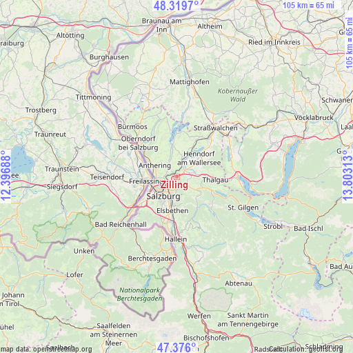
Zilling GPS coordinates[2]
47° 51' 0" North, 13° 6' 0" East
| Map corner | latitude | longitude |
|---|---|---|
| Upper-left | 48.3197°, | 12.39688° |
| Center: | 47.85°, | 13.1° |
| Lower-right: | 47.376°, | 13.80313° |
| Map W x H: | 104.9×104.9 km | = 65.2×65.2mi |
| max Lat: | 48.98333° ⇑41.3% North |
| Zilling: | 47.85° |
| min Lat: | ⇓58.7% South 46.48841° |
| min Long | Zilling | max Long |
| 9.57802° | 13.1° | 17.1° |
| W 18.6%⇐ | ⇒81.4% E |
Elevation
Elevation of Zilling is 544 m = 1785 ft, and this is 38.5 m = 126 ft above average elevation for this country.
| Max E: |
2140 m = 7021 ft | 36.2% |
| Zilling | 544 m 1785 ft | |
| Avg. | 505.5 m = 1658 ft | |
Min E: |
118 m = 387 ft | 63.8% |
See also: Austria elevation on elevation.city.
Geographical zone
Zilling is located in North temperate zone (between Tropic of Cancer and the Arctic Circle). Distance of this North polar circle is 2080.8 km =1292.9 mi to North.| Distance of | km | miles | from Zilling |
|---|---|---|---|
| North Pole | 4686.6 | 2912.1 | to North |
| Arctic Circle | 2080.8 | 1292.9 | to North |
| Tropic Cancer | 2714.5 | 1686.7 | to South |
| Equator | 5320.4 | 3305.9 | to South |


Nearby cities:
15 places around Zilling: (largest is in red/bold)
• Bergheim
5.3 km =3.3 mi,  249°
249°
• Brunn
5.2 km =3.2 mi,  30°
30°
• Elixhausen
3.1 km =1.9 mi,  306°
306°
• Esch
1.2 km =0.7 mi,  208°
208°
• Eugenbach
3.2 km =2 mi,  51°
51°
• Eugendorf
2.8 km =1.7 mi,  44°
44°
• Habach
5.9 km =3.7 mi,  127°
127°
• Hallwang
1.2 km =0.7 mi,  270°
270°
• Lengfelden
3.7 km =2.3 mi, 270°
• Reitberg
4.3 km =2.7 mi,  85°
85°
• Schwaighofen
3.5 km =2.2 mi, 126°
• Seekirchen am Wallersee
6.1 km =3.8 mi,  24°
24°
• Seewalchen
6.1 km =3.8 mi, 24°
• Waldprechting
5.7 km =3.5 mi,  12°
12°
• Wimmsiedlung
4.7 km =2.9 mi, 21°
Sources, notices
• [Note1] Compared only with cities in Austria existing in our database
• [Src1] Map data: © OpenStreetMap contributors (CC-BY-SA)
• [Src2] Other city data from geonames.org with taken over terms of usage.
• [Src3] Geographical zone / Annual Mean Temperature by Robert A. Rohde @ Wikipedia
