Kaltenbach geodata
Kaltenbach (Upper Austria) is a populated place; located in Austria in Europe/Vienna (GMT+2) time zone. With population of 1,516 people, there are 834 cities with bigger population in this country. Compared to other cities in Austria, 53.7% of cities are located further ↓South; 73.3% of cities are located further →East and 54% of cities have lower elevation than Kaltenbach. Note1
Administrative division(s):
- Level 1: Upper Austria
- Level 2: Politischer Bezirk Gmunden
- Level 3: Bad Ischl


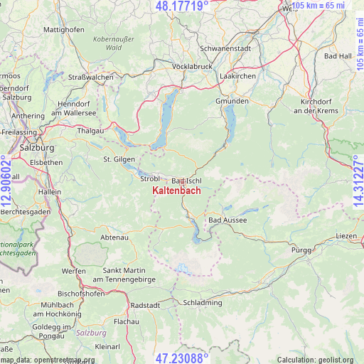
Kaltenbach GPS coordinates[2]
47° 42' 22.248" North, 13° 36' 32.904" East
| Map corner | latitude | longitude |
|---|---|---|
| Upper-left | 48.17719°, | 12.90602° |
| Center: | 47.70618°, | 13.60914° |
| Lower-right: | 47.23088°, | 14.31227° |
| Map W x H: | 105.2×105.2 km | = 65.4×65.4mi |
| max Lat: | 48.98333° ⇑46.3% North |
| Kaltenbach: | 47.70618° |
| min Lat: | ⇓53.7% South 46.48841° |
| min Long | Kaltenbach | max Long |
| 9.57802° | 13.60914° | 17.1° |
| W 26.7%⇐ | ⇒73.3% E |
Elevation
Elevation of Kaltenbach is 477 m = 1565 ft, and this is 28.5 m = 94 ft below average elevation for this country.
| Max E: |
2140 m = 7021 ft | 46% |
| Avg. | 505.5 m = 1658 ft | |
| Kaltenbach | 477 m = 1565 ft | |
Min E: |
118 m = 387 ft | 54% |
See also: Austria elevation on elevation.city.
Geographical zone
Kaltenbach is located in North temperate zone (between Tropic of Cancer and the Arctic Circle). Distance of this North polar circle is 2096.7 km =1302.8 mi to North.| Distance of | km | miles | from Kaltenbach |
|---|---|---|---|
| North Pole | 4702.6 | 2922.1 | to North |
| Arctic Circle | 2096.7 | 1302.8 | to North |
| Tropic Cancer | 2698.5 | 1676.8 | to South |
| Equator | 5304.4 | 3296 | to South |


Nearby cities:
15 places around Kaltenbach: (largest is in red/bold)
• Ahorn
0.8 km =0.5 mi,  325°
325°
• Aigen
5.7 km =3.5 mi,  263°
263°
• Bad Goisern
7.1 km =4.4 mi,  175°
175°
• Bad Ischl
0.9 km =0.6 mi,  53°
53°
• Gschwandt
8.3 km =5.2 mi, 175°
• Haiden
3.3 km =2.1 mi,  293°
293°
• Jainzen
1.3 km =0.8 mi,  25°
25°
• Kreutern
2.2 km =1.4 mi,  321°
321°
• Reiterndorf
1.5 km =0.9 mi,  100°
100°
• Rettenbach
4.6 km =2.9 mi, 53°
• Steinfeld
1.9 km =1.2 mi,  68°
68°
• Strobl
9.5 km =5.9 mi,  277°
277°
• Sulzbach
1.4 km =0.9 mi,  146°
146°
• Untersee
10.4 km =6.5 mi,  162°
162°
• Weissenbach
8.2 km =5.1 mi,  265°
265°
Sources, notices
• [Note1] Compared only with cities in Austria existing in our database
• [Src1] Map data: © OpenStreetMap contributors (CC-BY-SA)
• [Src2] Other city data from geonames.org with taken over terms of usage.
• [Src3] Geographical zone / Annual Mean Temperature by Robert A. Rohde @ Wikipedia
