Langenstein geodata
Langenstein (Upper Austria) is a populated place; located in Austria in Europe/Vienna (GMT+2) time zone. With population of 1,351 people, there are 936 cities with bigger population in this country. Compared to other cities in Austria, 82.9% of cities are located further ↓South; 53.7% of cities are located further →East and 84.9% of cities have higher elevation than Langenstein. Note1
Administrative division(s):
- Level 1: Upper Austria
- Level 2: Politischer Bezirk Perg
- Level 3: Langenstein


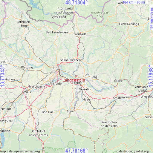
Langenstein GPS coordinates[2]
48° 15' 7.2" North, 14° 28' 35.58" East
| Map corner | latitude | longitude |
|---|---|---|
| Upper-left | 48.71804°, | 13.77343° |
| Center: | 48.252°, | 14.47655° |
| Lower-right: | 47.78168°, | 15.17968° |
| Map W x H: | 104.1×104.1 km | = 64.7×64.7mi |
| max Lat: | 48.98333° ⇑17.1% North |
| Langenstein: | 48.252° |
| min Lat: | ⇓82.9% South 46.48841° |
| min Long | Langenstein | max Long |
| 9.57802° | 14.47655° | 17.1° |
| W 46.3%⇐ | ⇒53.7% E |
Elevation
Elevation of Langenstein is 247 m = 810 ft, and this is 258.5 m = 848 ft below average elevation for this country.
| Max E: |
2140 m = 7021 ft | 84.9% |
| Avg. | 505.5 m = 1658 ft | |
| Langenstein | 247 m = 810 ft | |
Min E: |
118 m = 387 ft | 15.1% |
See also: Austria elevation on elevation.city.
Geographical zone
Langenstein is located in North temperate zone (between Tropic of Cancer and the Arctic Circle). Distance of this North polar circle is 2036.1 km =1265.2 mi to North.| Distance of | km | miles | from Langenstein |
|---|---|---|---|
| North Pole | 4641.9 | 2884.3 | to North |
| Arctic Circle | 2036.1 | 1265.2 | to North |
| Tropic Cancer | 2759.2 | 1714.5 | to South |
| Equator | 5365.1 | 3333.7 | to South |


Nearby cities:
15 places around Langenstein: (largest is in red/bold)
• Abwinden
3.8 km =2.4 mi,  281°
281°
• Asten
5.7 km =3.5 mi,  230°
230°
• Blindendorf
2.6 km =1.6 mi,  20°
20°
• Enns
4.3 km =2.7 mi,  180°
180°
• Ennsdorf
4.9 km =3 mi,  156°
156°
• Fisching
4.8 km =3 mi, 228°
• Gusen
1.3 km =0.8 mi,  303°
303°
• Heinrichsbrunn
4.4 km =2.7 mi,  102°
102°
• Kristein
4.4 km =2.7 mi,  206°
206°
• Luftenberg an der Donau
5.3 km =3.3 mi, 298°
• Mauthausen
3.4 km =2.1 mi,  110°
110°
• Ried in der Riedmark
4.4 km =2.7 mi,  60°
60°
• Sankt Georgen an der Gusen
3 km =1.9 mi,  317°
317°
• Statzing
4.3 km =2.7 mi,  306°
306°
• Ufer
1.8 km =1.1 mi, 103°
Sources, notices
• [Note1] Compared only with cities in Austria existing in our database
• [Src1] Map data: © OpenStreetMap contributors (CC-BY-SA)
• [Src2] Other city data from geonames.org with taken over terms of usage.
• [Src3] Geographical zone / Annual Mean Temperature by Robert A. Rohde @ Wikipedia
