Blindendorf geodata
Blindendorf (Upper Austria) is a populated place; located in Austria in Europe/Vienna (GMT+2) time zone. With population of 544 people, there are 2341 cities with bigger population in this country. Compared to other cities in Austria, 84.3% of cities are located further ↓South; 53.2% of cities are located further →East and 64.7% of cities have higher elevation than Blindendorf. Note1
Administrative division(s):
- Level 1: Upper Austria
- Level 2: Politischer Bezirk Perg
- Level 3: Ried in der Riedmark


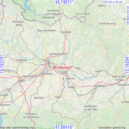
Blindendorf GPS coordinates[2]
48° 16' 27.408" North, 14° 29' 20.076" East
| Map corner | latitude | longitude |
|---|---|---|
| Upper-left | 48.74011°, | 13.78579° |
| Center: | 48.27428°, | 14.48891° |
| Lower-right: | 47.80416°, | 15.19204° |
| Map W x H: | 104.1×104.1 km | = 64.7×64.7mi |
| max Lat: | 48.98333° ⇑15.7% North |
| Blindendorf: | 48.27428° |
| min Lat: | ⇓84.3% South 46.48841° |
| min Long | Blindendorf | max Long |
| 9.57802° | 14.48891° | 17.1° |
| W 46.8%⇐ | ⇒53.2% E |
Elevation
Elevation of Blindendorf is 355 m = 1165 ft, and this is 150.5 m = 494 ft below average elevation for this country.
| Max E: |
2140 m = 7021 ft | 64.7% |
| Avg. | 505.5 m = 1658 ft | |
| Blindendorf | 355 m = 1165 ft | |
Min E: |
118 m = 387 ft | 35.3% |
See also: Austria elevation on elevation.city.
Geographical zone
Blindendorf is located in North temperate zone (between Tropic of Cancer and the Arctic Circle). Distance of this North polar circle is 2033.6 km =1263.6 mi to North.| Distance of | km | miles | from Blindendorf |
|---|---|---|---|
| North Pole | 4639.5 | 2882.9 | to North |
| Arctic Circle | 2033.6 | 1263.6 | to North |
| Tropic Cancer | 2761.7 | 1716 | to South |
| Equator | 5367.6 | 3335.3 | to South |


Nearby cities:
15 places around Blindendorf: (largest is in red/bold)
• Abwinden
4.9 km =3 mi,  249°
249°
• Doppl
6 km =3.7 mi,  81°
81°
• Gusen
2.7 km =1.7 mi,  228°
228°
• Heinrichsbrunn
4.9 km =3 mi,  135°
135°
• Katsdorf
5 km =3.1 mi,  347°
347°
• Langenstein
2.6 km =1.6 mi,  200°
200°
• Loitzenberg
4.7 km =2.9 mi,  91°
91°
• Luftenberg an der Donau
5.6 km =3.5 mi,  270°
270°
• Mauthausen
4.3 km =2.7 mi,  148°
148°
• Ried in der Riedmark
2.9 km =1.8 mi,  96°
96°
• Sankt Georgen an der Gusen
2.9 km =1.8 mi,  264°
264°
• Statzing
4.4 km =2.7 mi, 270°
• Ufer
3 km =1.9 mi,  164°
164°
• Unterjosefstal
6.7 km =4.2 mi,  72°
72°
• Wasserburg
5.4 km =3.4 mi, 90°
Sources, notices
• [Note1] Compared only with cities in Austria existing in our database
• [Src1] Map data: © OpenStreetMap contributors (CC-BY-SA)
• [Src2] Other city data from geonames.org with taken over terms of usage.
• [Src3] Geographical zone / Annual Mean Temperature by Robert A. Rohde @ Wikipedia
