Ennsdorf geodata
Ennsdorf (Lower Austria) is a seat of a third-order administrative division; located in Austria in Europe/Vienna (GMT+2) time zone. With population of 3,031 people, there are 375 cities with bigger population in this country. Compared to other cities in Austria, 80.2% of cities are located further ↓South; 53.1% of cities are located further →East and 85.4% of cities have higher elevation than Ennsdorf. Note1
Administrative division(s):
- Level 1: Lower Austria
- Level 2: Politischer Bezirk Amstetten
- Level 3: Ennsdorf


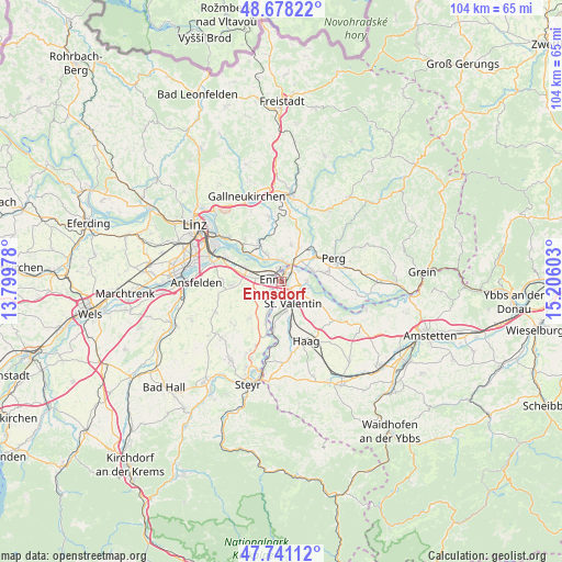
Ennsdorf GPS coordinates[2]
48° 12' 42.516" North, 14° 30' 10.44" East
| Map corner | latitude | longitude |
|---|---|---|
| Upper-left | 48.67822°, | 13.79978° |
| Center: | 48.21181°, | 14.5029° |
| Lower-right: | 47.74112°, | 15.20603° |
| Map W x H: | 104.2×104.2 km | = 64.7×64.7mi |
| max Lat: | 48.98333° ⇑19.8% North |
| Ennsdorf: | 48.21181° |
| min Lat: | ⇓80.2% South 46.48841° |
| min Long | Ennsdorf | max Long |
| 9.57802° | 14.5029° | 17.1° |
| W 46.9%⇐ | ⇒53.1% E |
Elevation
Elevation of Ennsdorf is 245 m = 804 ft, and this is 260.5 m = 855 ft below average elevation for this country.
| Max E: |
2140 m = 7021 ft | 85.4% |
| Avg. | 505.5 m = 1658 ft | |
| Ennsdorf | 245 m = 804 ft | |
Min E: |
118 m = 387 ft | 14.6% |
See also: Austria elevation on elevation.city.
Geographical zone
Ennsdorf is located in North temperate zone (between Tropic of Cancer and the Arctic Circle). Distance of this North polar circle is 2040.5 km =1267.9 mi to North.| Distance of | km | miles | from Ennsdorf |
|---|---|---|---|
| North Pole | 4646.4 | 2887.1 | to North |
| Arctic Circle | 2040.5 | 1267.9 | to North |
| Tropic Cancer | 2754.7 | 1711.7 | to South |
| Equator | 5360.7 | 3331 | to South |


Nearby cities:
15 places around Ennsdorf: (largest is in red/bold)
• Asten
6.4 km =4 mi,  277°
277°
• Au an der Donau
6.2 km =3.9 mi,  72°
72°
• Enns
2 km =1.2 mi, 275°
• Erla
5.2 km =3.2 mi,  105°
105°
• Fisching
5.7 km =3.5 mi, 282°
• Gusen
6 km =3.7 mi,  329°
329°
• Heinrichsbrunn
4.2 km =2.6 mi,  34°
34°
• Hiesendorf
3.3 km =2.1 mi,  214°
214°
• Kristein
4 km =2.5 mi, 277°
• Langenstein
4.9 km =3 mi,  336°
336°
• Mauthausen
3.5 km =2.2 mi,  20°
20°
• Sankt Pantaleon
4.8 km =3 mi,  91°
91°
• Sankt Valentin
5.1 km =3.2 mi,  168°
168°
• Thaling
4.7 km =2.9 mi, 210°
• Ufer
4.1 km =2.5 mi,  356°
356°
Sources, notices
• [Note1] Compared only with cities in Austria existing in our database
• [Src1] Map data: © OpenStreetMap contributors (CC-BY-SA)
• [Src2] Other city data from geonames.org with taken over terms of usage.
• [Src3] Geographical zone / Annual Mean Temperature by Robert A. Rohde @ Wikipedia
