Lafnitz geodata
Lafnitz (Styria) is a seat of a third-order administrative division; located in Austria in Europe/Vienna (GMT+1) time zone. With population of 967 people, there are 1340 cities with bigger population in this country. Compared to other cities in Austria, 61.5% of cities are located further ↑North; 80.6% of cities are located further ←West and 57.4% of cities have higher elevation than Lafnitz. Note1
Administrative division(s):
- Level 1: Styria
- Level 2: Politischer Bezirk Hartberg-Fürstenfeld
- Level 3: Lafnitz


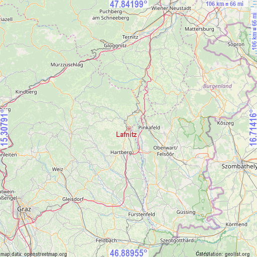
Lafnitz GPS coordinates[2]
47° 22' 4.512" North, 16° 0' 39.708" East
| Map corner | latitude | longitude |
|---|---|---|
| Upper-left | 47.84199°, | 15.30791° |
| Center: | 47.36792°, | 16.01103° |
| Lower-right: | 46.88955°, | 16.71416° |
| Map W x H: | 105.9×105.9 km | = 65.8×65.8mi |
| max Lat: | 48.98333° ⇑61.5% North |
| Lafnitz: | 47.36792° |
| min Lat: | ⇓38.5% South 46.48841° |
| min Long | Lafnitz | max Long |
| 9.57802° | 16.01103° | 17.1° |
| W 80.6%⇐ | ⇒19.4% E |
Elevation
Elevation of Lafnitz is 402 m = 1319 ft, and this is 103.5 m = 340 ft below average elevation for this country.
| Max E: |
2140 m = 7021 ft | 57.4% |
| Avg. | 505.5 m = 1658 ft | |
| Lafnitz | 402 m = 1319 ft | |
Min E: |
118 m = 387 ft | 42.6% |
See also: Austria elevation on elevation.city.
Geographical zone
Lafnitz is located in North temperate zone (between Tropic of Cancer and the Arctic Circle). Distance of this North polar circle is 2134.4 km =1326.3 mi to North.| Distance of | km | miles | from Lafnitz |
|---|---|---|---|
| North Pole | 4740.2 | 2945.4 | to North |
| Arctic Circle | 2134.4 | 1326.3 | to North |
| Tropic Cancer | 2660.9 | 1653.4 | to South |
| Equator | 5266.8 | 3272.6 | to South |


Nearby cities:
15 places around Lafnitz: (largest is in red/bold)
• Dechantskirchen
5.4 km =3.4 mi,  4°
4°
• Eggendorf
8 km =5 mi,  182°
182°
• Ehrenschachen
5.5 km =3.4 mi,  35°
35°
• Eichberg
3.2 km =2 mi,  298°
298°
• Friedberg
7.8 km =4.8 mi,  21°
21°
• Grafendorf bei Hartberg
3.4 km =2.1 mi,  206°
206°
• Grafenschachen
4.2 km =2.6 mi,  91°
91°
• Loipersdorf im Burgenland
6.7 km =4.2 mi,  125°
125°
• Neustift an der Lafnitz
1.7 km =1.1 mi, 94°
• Pinkafeld
8 km =5 mi, 91°
• Pongrazen bei Hartberg
8.1 km =5 mi,  249°
249°
• Rohrbach an der Lafnitz
1.9 km =1.2 mi,  334°
334°
• Seibersdorf am Hammerwald
4.8 km =3 mi,  198°
198°
• Stambach
7 km =4.3 mi,  236°
236°
• Staudach
7.7 km =4.8 mi,  218°
218°
Sources, notices
• [Note1] Compared only with cities in Austria existing in our database
• [Src1] Map data: © OpenStreetMap contributors (CC-BY-SA)
• [Src2] Other city data from geonames.org with taken over terms of usage.
• [Src3] Geographical zone / Annual Mean Temperature by Robert A. Rohde @ Wikipedia
