Grafenschachen geodata
Grafenschachen (Burgenland) is a seat of a third-order administrative division; located in Austria in Europe/Vienna (GMT+2) time zone. With population of 968 people, there are 1339 cities with bigger population in this country. Compared to other cities in Austria, 61.9% of cities are located further ↑North; 82.1% of cities are located further ←West and 55.1% of cities have higher elevation than Grafenschachen. Note1
Administrative division(s):
- Level 1: Burgenland
- Level 2: Politischer Bezirk Oberwart
- Level 3: Grafenschachen


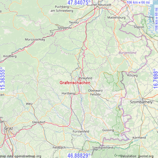
Grafenschachen GPS coordinates[2]
47° 22' 0.012" North, 16° 4' 0.012" East
| Map corner | latitude | longitude |
|---|---|---|
| Upper-left | 47.84075°, | 15.36355° |
| Center: | 47.36667°, | 16.06667° |
| Lower-right: | 46.88829°, | 16.7698° |
| Map W x H: | 105.9×105.9 km | = 65.8×65.8mi |
| max Lat: | 48.98333° ⇑61.9% North |
| Grafenschachen: | 47.36667° |
| min Lat: | ⇓38.1% South 46.48841° |
| min Long | Grafenschachen | max Long |
| 9.57802° | 16.06667° | 17.1° |
| W 82.1%⇐ | ⇒17.9% E |
Elevation
Elevation of Grafenschachen is 419 m = 1375 ft, and this is 86.5 m = 284 ft below average elevation for this country.
| Max E: |
2140 m = 7021 ft | 55.1% |
| Avg. | 505.5 m = 1658 ft | |
| Grafenschachen | 419 m = 1375 ft | |
Min E: |
118 m = 387 ft | 44.9% |
See also: Austria elevation on elevation.city.
Geographical zone
Grafenschachen is located in North temperate zone (between Tropic of Cancer and the Arctic Circle). Distance of this North polar circle is 2134.5 km =1326.3 mi to North.| Distance of | km | miles | from Grafenschachen |
|---|---|---|---|
| North Pole | 4740.4 | 2945.5 | to North |
| Arctic Circle | 2134.5 | 1326.3 | to North |
| Tropic Cancer | 2660.8 | 1653.3 | to South |
| Equator | 5266.7 | 3272.6 | to South |


Nearby cities:
15 places around Grafenschachen: (largest is in red/bold)
• Buchschachen
6.1 km =3.8 mi,  155°
155°
• Dechantskirchen
6.7 km =4.2 mi,  325°
325°
• Ehrenschachen
4.7 km =2.9 mi,  348°
348°
• Eichberg
7.2 km =4.5 mi,  283°
283°
• Friedberg
7.5 km =4.7 mi, 350°
• Grafendorf bei Hartberg
6.4 km =4 mi,  242°
242°
• Lafnitz
4.2 km =2.6 mi,  271°
271°
• Loipersdorf im Burgenland
3.9 km =2.4 mi, 161°
• Neustift an der Lafnitz
2.5 km =1.6 mi, 270°
• Pinggau
8.4 km =5.2 mi,  0°
0°
• Pinkafeld
3.8 km =2.4 mi,  90°
90°
• Riedlingsdorf
5.4 km =3.4 mi,  110°
110°
• Rohrbach an der Lafnitz
5.4 km =3.4 mi,  290°
290°
• Seibersdorf am Hammerwald
7.2 km =4.5 mi,  232°
232°
• Wiesfleck
6.3 km =3.9 mi,  71°
71°
Sources, notices
• [Note1] Compared only with cities in Austria existing in our database
• [Src1] Map data: © OpenStreetMap contributors (CC-BY-SA)
• [Src2] Other city data from geonames.org with taken over terms of usage.
• [Src3] Geographical zone / Annual Mean Temperature by Robert A. Rohde @ Wikipedia
