Ehrenschachen geodata
Ehrenschachen (Styria) is a populated place; located in Austria in Europe/Vienna (GMT+2) time zone. With population of 651 people, there are 1982 cities with bigger population in this country. Compared to other cities in Austria, 59.2% of cities are located further ↑North; 81.8% of cities are located further ←West and 52.7% of cities have lower elevation than Ehrenschachen. Note1
Administrative division(s):
- Level 1: Styria
- Level 2: Politischer Bezirk Hartberg-Fürstenfeld
- Level 3: Friedberg


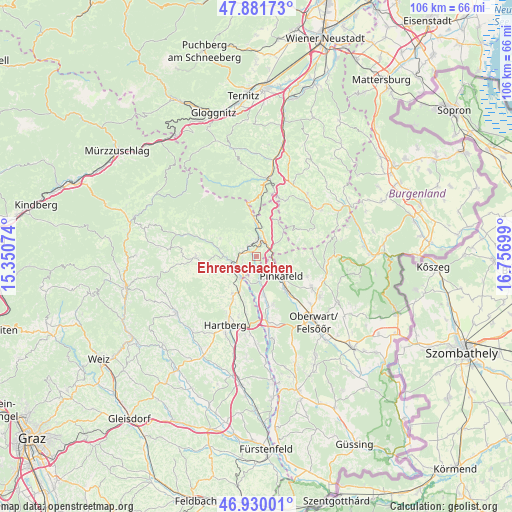
Ehrenschachen GPS coordinates[2]
47° 24' 28.872" North, 16° 3' 13.896" East
| Map corner | latitude | longitude |
|---|---|---|
| Upper-left | 47.88173°, | 15.35074° |
| Center: | 47.40802°, | 16.05386° |
| Lower-right: | 46.93001°, | 16.75699° |
| Map W x H: | 105.8×105.8 km | = 65.7×65.7mi |
| max Lat: | 48.98333° ⇑59.2% North |
| Ehrenschachen: | 47.40802° |
| min Lat: | ⇓40.8% South 46.48841° |
| min Long | Ehrenschachen | max Long |
| 9.57802° | 16.05386° | 17.1° |
| W 81.8%⇐ | ⇒18.2% E |
Elevation
Elevation of Ehrenschachen is 470 m = 1542 ft, and this is 35.5 m = 116 ft below average elevation for this country.
| Max E: |
2140 m = 7021 ft | 47.3% |
| Avg. | 505.5 m = 1658 ft | |
| Ehrenschachen | 470 m = 1542 ft | |
Min E: |
118 m = 387 ft | 52.7% |
See also: Austria elevation on elevation.city.
Geographical zone
Ehrenschachen is located in North temperate zone (between Tropic of Cancer and the Arctic Circle). Distance of this North polar circle is 2129.9 km =1323.5 mi to North.| Distance of | km | miles | from Ehrenschachen |
|---|---|---|---|
| North Pole | 4735.8 | 2942.7 | to North |
| Arctic Circle | 2129.9 | 1323.5 | to North |
| Tropic Cancer | 2665.4 | 1656.2 | to South |
| Equator | 5271.3 | 3275.4 | to South |


Nearby cities:
15 places around Ehrenschachen: (largest is in red/bold)
• Dechantskirchen
3 km =1.9 mi,  288°
288°
• Eichberg
6.7 km =4.2 mi,  244°
244°
• Friedberg
2.8 km =1.7 mi,  354°
354°
• Grafenschachen
4.7 km =2.9 mi,  168°
168°
• Lafnitz
5.5 km =3.4 mi,  215°
215°
• Loipersdorf im Burgenland
8.6 km =5.3 mi, 165°
• Neustift an der Lafnitz
4.9 km =3 mi,  198°
198°
• Ortgraben
4.7 km =2.9 mi,  356°
356°
• Pinggau
3.9 km =2.4 mi,  14°
14°
• Pinkafeld
6.6 km =4.1 mi,  134°
134°
• Riedlingsdorf
8.8 km =5.5 mi,  137°
137°
• Rohrbach an der Lafnitz
4.9 km =3 mi, 235°
• Sankt Lorenzen am Wechsel
8.3 km =5.2 mi,  296°
296°
• Schäffern
8.8 km =5.5 mi,  28°
28°
• Wiesfleck
7.4 km =4.6 mi,  110°
110°
Sources, notices
• [Note1] Compared only with cities in Austria existing in our database
• [Src1] Map data: © OpenStreetMap contributors (CC-BY-SA)
• [Src2] Other city data from geonames.org with taken over terms of usage.
• [Src3] Geographical zone / Annual Mean Temperature by Robert A. Rohde @ Wikipedia
