Klein-Pöchlarn geodata
Klein-Pöchlarn (Lower Austria) is a seat of a third-order administrative division; located in Austria in Europe/Vienna (GMT+2) time zone. With population of 991 people, there are 1307 cities with bigger population in this country. Compared to other cities in Austria, 80.4% of cities are located further ↓South; 57.8% of cities are located further ←West and 90.7% of cities have higher elevation than Klein-Pöchlarn. Note1
Administrative division(s):
- Level 1: Lower Austria
- Level 2: Politischer Bezirk Melk
- Level 3: Klein-Pöchlarn


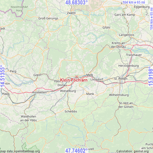
Klein-Pöchlarn GPS coordinates[2]
48° 13' 0.012" North, 15° 13' 0.012" East
| Map corner | latitude | longitude |
|---|---|---|
| Upper-left | 48.68303°, | 14.51355° |
| Center: | 48.21667°, | 15.21667° |
| Lower-right: | 47.74602°, | 15.9198° |
| Map W x H: | 104.2×104.2 km | = 64.7×64.7mi |
| max Lat: | 48.98333° ⇑19.6% North |
| Klein-Pöchlarn: | 48.21667° |
| min Lat: | ⇓80.4% South 46.48841° |
| min Long | Klein-Pöchlarn | max Long |
| 9.57802° | 15.21667° | 17.1° |
| W 57.8%⇐ | ⇒42.2% E |
Elevation
Elevation of Klein-Pöchlarn is 209 m = 686 ft, and this is 296.5 m = 973 ft below average elevation for this country.
| Max E: |
2140 m = 7021 ft | 90.7% |
| Avg. | 505.5 m = 1658 ft | |
| Klein-Pöchlarn | 209 m = 686 ft | |
Min E: |
118 m = 387 ft | 9.3% |
See also: Austria elevation on elevation.city.
Geographical zone
Klein-Pöchlarn is located in North temperate zone (between Tropic of Cancer and the Arctic Circle). Distance of this North polar circle is 2040 km =1267.6 mi to North.| Distance of | km | miles | from Klein-Pöchlarn |
|---|---|---|---|
| North Pole | 4645.9 | 2886.8 | to North |
| Arctic Circle | 2040 | 1267.6 | to North |
| Tropic Cancer | 2755.3 | 1712.1 | to South |
| Equator | 5361.2 | 3331.3 | to South |


Nearby cities:
15 places around Klein-Pöchlarn: (largest is in red/bold)
• Bergland
7.1 km =4.4 mi,  198°
198°
• Emmersdorf an der Donau
9.3 km =5.8 mi,  72°
72°
• Erlauf
4.5 km =2.8 mi,  213°
213°
• Golling
3.1 km =1.9 mi,  233°
233°
• Gottsdorf
8.6 km =5.3 mi,  249°
249°
• Krummnußbaum an der Donauuferbahn
3.8 km =2.4 mi,  269°
269°
• Krumnussbaum
4.1 km =2.5 mi,  257°
257°
• Leiben
5.4 km =3.4 mi,  52°
52°
• Marbach an der Donau
4.9 km =3 mi, 270°
• Maria Taferl
4.4 km =2.7 mi,  285°
285°
• Matzleinsdorf
4.1 km =2.5 mi,  116°
116°
• Melk
8.6 km =5.3 mi,  82°
82°
• Neuda
2.9 km =1.8 mi,  241°
241°
• Petzenkirchen
9 km =5.6 mi, 210°
• Pöchlarn
2.2 km =1.4 mi, 213°
Sources, notices
• [Note1] Compared only with cities in Austria existing in our database
• [Src1] Map data: © OpenStreetMap contributors (CC-BY-SA)
• [Src2] Other city data from geonames.org with taken over terms of usage.
• [Src3] Geographical zone / Annual Mean Temperature by Robert A. Rohde @ Wikipedia
