Kematen an der Krems geodata
Kematen an der Krems (Upper Austria) is a populated place; located in Austria in Europe/Vienna (GMT+2) time zone. With population of 1,613 people, there are 775 cities with bigger population in this country. Compared to other cities in Austria, 73.3% of cities are located further ↓South; 60.6% of cities are located further →East and 74.3% of cities have higher elevation than Kematen an der Krems. Note1
Administrative division(s):
- Level 1: Upper Austria
- Level 2: Politischer Bezirk Linz-Land
- Level 3: Kematen an der Krems


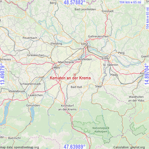
Kematen an der Krems GPS coordinates[2]
48° 6' 41.4" North, 14° 11' 38.076" East
| Map corner | latitude | longitude |
|---|---|---|
| Upper-left | 48.57882°, | 13.49079° |
| Center: | 48.1115°, | 14.19391° |
| Lower-right: | 47.63989°, | 14.89704° |
| Map W x H: | 104.4×104.4 km | = 64.9×64.9mi |
| max Lat: | 48.98333° ⇑26.7% North |
| Kematen an der Krems: | 48.1115° |
| min Lat: | ⇓73.3% South 46.48841° |
| min Long | Kematen an der | max Long |
| 9.57802° | 14.19391° | 17.1° |
| W 39.4%⇐ | ⇒60.6% E |
Elevation
Elevation of Kematen an der Krems is 307 m = 1007 ft, and this is 198.5 m = 651 ft below average elevation for this country.
| Max E: |
2140 m = 7021 ft | 74.3% |
| Avg. | 505.5 m = 1658 ft | |
| Kematen an der Krems | 307 m = 1007 ft | |
Min E: |
118 m = 387 ft | 25.7% |
See also: Austria elevation on elevation.city.
Geographical zone
Kematen an der Krems is located in North temperate zone (between Tropic of Cancer and the Arctic Circle). Distance of this North polar circle is 2051.7 km =1274.9 mi to North.| Distance of | km | miles | from Kematen an der Krems |
|---|---|---|---|
| North Pole | 4657.6 | 2894.1 | to North |
| Arctic Circle | 2051.7 | 1274.9 | to North |
| Tropic Cancer | 2743.6 | 1704.8 | to South |
| Equator | 5349.5 | 3324 | to South |


Nearby cities:
15 places around Kematen an der Krems: (largest is in red/bold)
• Allhaming
4.9 km =3 mi,  338°
338°
• Bad Hall
8.2 km =5.1 mi,  172°
172°
• Bergern
8.7 km =5.4 mi,  315°
315°
• Eggendorf im Traunkreis
4.3 km =2.7 mi,  300°
300°
• Kremsmünster
8.1 km =5 mi,  216°
216°
• Neuhofen an der Krems
3.9 km =2.4 mi,  39°
39°
• Nöstlbach
7.2 km =4.5 mi,  32°
32°
• Piberbach
2.4 km =1.5 mi,  80°
80°
• Pucking
8.6 km =5.3 mi,  357°
357°
• Rohr im Kremstal
4.8 km =3 mi,  180°
180°
• Sammersdorf
8 km =5 mi,  345°
345°
• Sankt Marien
7.4 km =4.6 mi,  56°
56°
• Sipbachzell
6.4 km =4 mi,  255°
255°
• Weifersdorf
3.5 km =2.2 mi, 58°
• Weisskirchen an der Traun
7.6 km =4.7 mi, 317°
Sources, notices
• [Note1] Compared only with cities in Austria existing in our database
• [Src1] Map data: © OpenStreetMap contributors (CC-BY-SA)
• [Src2] Other city data from geonames.org with taken over terms of usage.
• [Src3] Geographical zone / Annual Mean Temperature by Robert A. Rohde @ Wikipedia
