Lanzenkirchen geodata
Lanzenkirchen (Lower Austria) is a seat of a third-order administrative division; located in Austria in Europe/Vienna (GMT+2) time zone. With population of 837 people, there are 1541 cities with bigger population in this country. Compared to other cities in Austria, 55% of cities are located further ↓South; 86.7% of cities are located further ←West and 74.8% of cities have higher elevation than Lanzenkirchen. Note1
Administrative division(s):
- Level 1: Lower Austria
- Level 2: Politischer Bezirk Wiener Neustadt
- Level 3: Lanzenkirchen


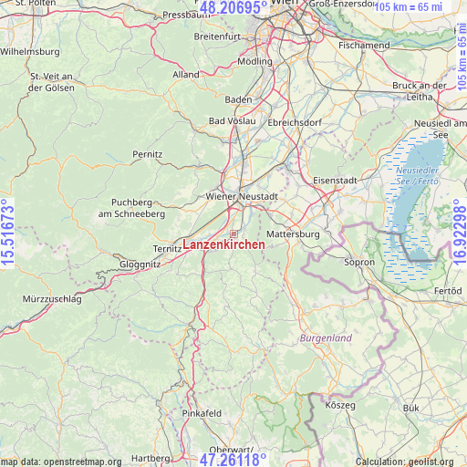
Lanzenkirchen GPS coordinates[2]
47° 44' 10.356" North, 16° 13' 11.46" East
| Map corner | latitude | longitude |
|---|---|---|
| Upper-left | 48.20695°, | 15.51673° |
| Center: | 47.73621°, | 16.21985° |
| Lower-right: | 47.26118°, | 16.92298° |
| Map W x H: | 105.2×105.2 km | = 65.4×65.4mi |
| max Lat: | 48.98333° ⇑45% North |
| Lanzenkirchen: | 47.73621° |
| min Lat: | ⇓55% South 46.48841° |
| min Long | Lanzenkirchen | max Long |
| 9.57802° | 16.21985° | 17.1° |
| W 86.7%⇐ | ⇒13.3% E |
Elevation
Elevation of Lanzenkirchen is 304 m = 997 ft, and this is 201.5 m = 661 ft below average elevation for this country.
| Max E: |
2140 m = 7021 ft | 74.8% |
| Avg. | 505.5 m = 1658 ft | |
| Lanzenkirchen | 304 m = 997 ft | |
Min E: |
118 m = 387 ft | 25.2% |
See also: Austria elevation on elevation.city.
Geographical zone
Lanzenkirchen is located in North temperate zone (between Tropic of Cancer and the Arctic Circle). Distance of this North polar circle is 2093.4 km =1300.8 mi to North.| Distance of | km | miles | from Lanzenkirchen |
|---|---|---|---|
| North Pole | 4699.3 | 2920 | to North |
| Arctic Circle | 2093.4 | 1300.8 | to North |
| Tropic Cancer | 2701.9 | 1678.9 | to South |
| Equator | 5307.8 | 3298.1 | to South |


Nearby cities:
15 places around Lanzenkirchen: (largest is in red/bold)
• Bad Erlach
1.1 km =0.7 mi,  202°
202°
• Breitenau
5.7 km =3.5 mi,  267°
267°
• Bromberg
7.9 km =4.9 mi,  185°
185°
• Frohsdorf
2.3 km =1.4 mi,  98°
98°
• Haderswörth
2.3 km =1.4 mi, 98°
• Katzelsdorf
6.2 km =3.9 mi,  37°
37°
• Kleinwolkersdorf
2.7 km =1.7 mi,  55°
55°
• Loipersbach
8 km =5 mi,  254°
254°
• Peisching
8.1 km =5 mi,  261°
261°
• Pitten
3.5 km =2.2 mi,  231°
231°
• Schwarzau am Steinfeld
3.7 km =2.3 mi, 262°
• Seebenstein
6.9 km =4.3 mi, 233°
• Walpersbach
2.4 km =1.5 mi,  155°
155°
• Wiener Neustadt
7.7 km =4.8 mi,  6°
6°
• Wiesen
8.8 km =5.5 mi,  88°
88°
Sources, notices
• [Note1] Compared only with cities in Austria existing in our database
• [Src1] Map data: © OpenStreetMap contributors (CC-BY-SA)
• [Src2] Other city data from geonames.org with taken over terms of usage.
• [Src3] Geographical zone / Annual Mean Temperature by Robert A. Rohde @ Wikipedia
