Ischgl geodata
Ischgl (Tyrol) is a seat of a third-order administrative division; located in Austria in Europe/Vienna (GMT+2) time zone. With population of 1,233 people, there are 1021 cities with bigger population in this country. Compared to other cities in Austria, 83.8% of cities are located further ↑North; 96.5% of cities are located further →East and 99.3% of cities have lower elevation than Ischgl. Note1


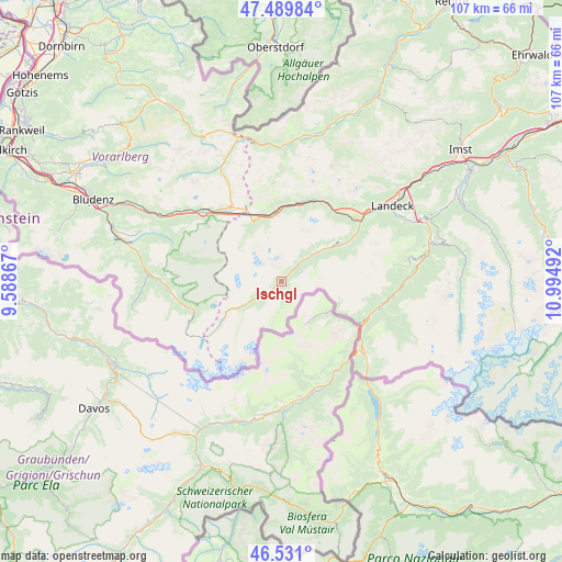
Ischgl GPS coordinates[2]
47° 0' 45.252" North, 10° 17' 30.444" East
| Map corner | latitude | longitude |
|---|---|---|
| Upper-left | 47.48984°, | 9.58867° |
| Center: | 47.01257°, | 10.29179° |
| Lower-right: | 46.531°, | 10.99492° |
| Map W x H: | 106.6×106.6 km | = 66.2×66.2mi |
| max Lat: | 48.98333° ⇑83.8% North |
| Ischgl: | 47.01257° |
| min Lat: | ⇓16.2% South 46.48841° |
| min Long | Ischgl | max Long |
| 9.57802° | 10.29179° | 17.1° |
| W 3.5%⇐ | ⇒96.5% E |
Elevation
Elevation of Ischgl is 1378 m = 4521 ft, and this is 872.5 m = 2863 ft above average elevation for this country.
| Max E: |
2140 m = 7021 ft | 0.7% |
| Ischgl | 1378 m 4521 ft | |
| Avg. | 505.5 m = 1658 ft | |
Min E: |
118 m = 387 ft | 99.3% |
See also: Austria elevation on elevation.city.
Geographical zone
Ischgl is located in North temperate zone (between Tropic of Cancer and the Arctic Circle). Distance of this North polar circle is 2173.9 km =1350.8 mi to North.| Distance of | km | miles | from Ischgl |
|---|---|---|---|
| North Pole | 4779.8 | 2970 | to North |
| Arctic Circle | 2173.9 | 1350.8 | to North |
| Tropic Cancer | 2621.4 | 1628.9 | to South |
| Equator | 5227.3 | 3248.1 | to South |


Nearby cities:
15 places around Ischgl: (largest is in red/bold)
• Flirsch
17.3 km =10.7 mi,  28°
28°
• Galtür
9.7 km =6 mi,  238°
238°
• Gaschurn
20.3 km =12.6 mi,  261°
261°
• Grins
22 km =13.7 mi,  49°
49°
• Kappl
9.2 km =5.7 mi, 49°
• Klösterle
20.7 km =12.9 mi,  310°
310°
• Nauders
21 km =13 mi,  130°
130°
• Pettneu
15.2 km =9.4 mi,  12°
12°
• Pfunds
20.2 km =12.6 mi,  104°
104°
• Pians
21.5 km =13.4 mi, 50°
• Sankt Jakob
14.3 km =8.9 mi,  0°
0°
• See
15.4 km =9.6 mi,  59°
59°
• St Anton am Arlberg
13 km =8.1 mi,  350°
350°
• Strengen
18 km =11.2 mi, 45°
• Tobadill
21 km =13 mi, 53°
Sources, notices
• [Note1] Compared only with cities in Austria existing in our database
• [Src1] Map data: © OpenStreetMap contributors (CC-BY-SA)
• [Src2] Other city data from geonames.org with taken over terms of usage.
• [Src3] Geographical zone / Annual Mean Temperature by Robert A. Rohde @ Wikipedia
