Hüttschlag geodata
Hüttschlag (Salzburg) is a seat of a third-order administrative division; located in Austria in Europe/Vienna (GMT+2) time zone. With population of 605 people, there are 2121 cities with bigger population in this country. Compared to other cities in Austria, 74.2% of cities are located further ↑North; 78.6% of cities are located further →East and 93.6% of cities have lower elevation than Hüttschlag. Note1
Administrative division(s):
- Level 1: Salzburg
- Level 2: Politischer Bezirk Sankt Johann im Pongau
- Level 3: Hüttschlag


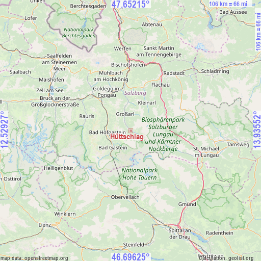
Hüttschlag GPS coordinates[2]
47° 10' 34.86" North, 13° 13' 56.604" East
| Map corner | latitude | longitude |
|---|---|---|
| Upper-left | 47.65215°, | 12.52927° |
| Center: | 47.17635°, | 13.23239° |
| Lower-right: | 46.69625°, | 13.93552° |
| Map W x H: | 106.3×106.3 km | = 66.1×66.1mi |
| max Lat: | 48.98333° ⇑74.2% North |
| Hüttschlag: | 47.17635° |
| min Lat: | ⇓25.8% South 46.48841° |
| min Long | Hüttschlag | max Long |
| 9.57802° | 13.23239° | 17.1° |
| W 21.4%⇐ | ⇒78.6% E |
Elevation
Elevation of Hüttschlag is 974 m = 3196 ft, and this is 468.5 m = 1537 ft above average elevation for this country.
| Max E: |
2140 m = 7021 ft | 6.4% |
| Hüttschlag | 974 m 3196 ft | |
| Avg. | 505.5 m = 1658 ft | |
Min E: |
118 m = 387 ft | 93.6% |
See also: Austria elevation on elevation.city.
Geographical zone
Hüttschlag is located in North temperate zone (between Tropic of Cancer and the Arctic Circle). Distance of this North polar circle is 2155.7 km =1339.5 mi to North.| Distance of | km | miles | from Hüttschlag |
|---|---|---|---|
| North Pole | 4761.5 | 2958.7 | to North |
| Arctic Circle | 2155.7 | 1339.5 | to North |
| Tropic Cancer | 2639.6 | 1640.2 | to South |
| Equator | 5245.5 | 3259.4 | to South |


Nearby cities:
15 places around Hüttschlag: (largest is in red/bold)
• Anger
9.8 km =6.1 mi,  256°
256°
• Bad Gastein
10 km =6.2 mi,  227°
227°
• Bad Hofgastein
10.1 km =6.3 mi,  267°
267°
• Dorfgastein
12.2 km =7.6 mi,  306°
306°
• Goldegg
18.8 km =11.7 mi,  327°
327°
• Grossarl
6.8 km =4.2 mi,  338°
338°
• Heissingfelding
9.2 km =5.7 mi, 261°
• Hofmarkt
16 km =9.9 mi,  19°
19°
• Kleinarl
13 km =8.1 mi,  30°
30°
• Plankenau
17 km =10.6 mi,  349°
349°
• Rauris
18.8 km =11.7 mi,  287°
287°
• Sankt Veit im Pongau
18.5 km =11.5 mi, 340°
• Schwarzach im Pongau
17.1 km =10.6 mi, 339°
• Vorderschneeberg
10 km =6.2 mi,  249°
249°
• Wagrain
18.4 km =11.4 mi, 15°
Sources, notices
• [Note1] Compared only with cities in Austria existing in our database
• [Src1] Map data: © OpenStreetMap contributors (CC-BY-SA)
• [Src2] Other city data from geonames.org with taken over terms of usage.
• [Src3] Geographical zone / Annual Mean Temperature by Robert A. Rohde @ Wikipedia
