Bad Hofgastein geodata
Bad Hofgastein (Salzburg) is a seat of a third-order administrative division; located in Austria in Europe/Vienna (GMT+2) time zone. With population of 2,951 people, there are 389 cities with bigger population in this country. Compared to other cities in Austria, 74.4% of cities are located further ↑North; 81.5% of cities are located further →East and 87.5% of cities have lower elevation than Bad Hofgastein. Note1
Administrative division(s):
- Level 1: Salzburg
- Level 2: Politischer Bezirk Sankt Johann im Pongau
- Level 3: Bad Hofgastein


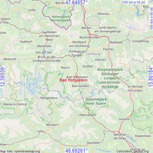
Bad Hofgastein GPS coordinates[2]
47° 10' 21.864" North, 13° 5' 55.356" East
| Map corner | latitude | longitude |
|---|---|---|
| Upper-left | 47.64857°, | 12.39559° |
| Center: | 47.17274°, | 13.09871° |
| Lower-right: | 46.69261°, | 13.80184° |
| Map W x H: | 106.3×106.3 km | = 66.1×66.1mi |
| max Lat: | 48.98333° ⇑74.4% North |
| Bad Hofgastein: | 47.17274° |
| min Lat: | ⇓25.6% South 46.48841° |
| min Long | Bad Hofgastein | max Long |
| 9.57802° | 13.09871° | 17.1° |
| W 18.5%⇐ | ⇒81.5% E |
Elevation
Elevation of Bad Hofgastein is 836 m = 2743 ft, and this is 330.5 m = 1084 ft above average elevation for this country.
| Max E: |
2140 m = 7021 ft | 12.5% |
| Bad Hofgastein | 836 m 2743 ft | |
| Avg. | 505.5 m = 1658 ft | |
Min E: |
118 m = 387 ft | 87.5% |
See also: Austria elevation on elevation.city.
Geographical zone
Bad Hofgastein is located in North temperate zone (between Tropic of Cancer and the Arctic Circle). Distance of this North polar circle is 2156.1 km =1339.7 mi to North.| Distance of | km | miles | from Bad Hofgastein |
|---|---|---|---|
| North Pole | 4761.9 | 2958.9 | to North |
| Arctic Circle | 2156.1 | 1339.7 | to North |
| Tropic Cancer | 2639.2 | 1639.9 | to South |
| Equator | 5245.1 | 3259.2 | to South |


Nearby cities:
15 places around Bad Hofgastein: (largest is in red/bold)
• Anger
1.9 km =1.2 mi,  163°
163°
• Bad Gastein
6.9 km =4.3 mi, 156°
• Dorfgastein
7.7 km =4.8 mi,  1°
1°
• Goldegg
16.2 km =10.1 mi, 0°
• Grossarl
10.2 km =6.3 mi,  48°
48°
• Heissingfelding
1.4 km =0.9 mi,  132°
132°
• Hüttschlag
10.1 km =6.3 mi,  87°
87°
• Lend
14.4 km =8.9 mi,  345°
345°
• Plankenau
18.5 km =11.5 mi,  22°
22°
• Rauris
9.9 km =6.2 mi,  307°
307°
• Sankt Veit im Pongau
18.3 km =11.4 mi,  12°
12°
• Schwarzach im Pongau
16.9 km =10.5 mi, 13°
• Taxenbach
16.7 km =10.4 mi,  321°
321°
• Vorderschneeberg
3.3 km =2.1 mi,  166°
166°
• Wörtherberg
9.6 km =6 mi,  295°
295°
Sources, notices
• [Note1] Compared only with cities in Austria existing in our database
• [Src1] Map data: © OpenStreetMap contributors (CC-BY-SA)
• [Src2] Other city data from geonames.org with taken over terms of usage.
• [Src3] Geographical zone / Annual Mean Temperature by Robert A. Rohde @ Wikipedia
