Hochburg-Ach geodata
Hochburg-Ach (Upper Austria) is a seat of a third-order administrative division; located in Austria in Europe/Vienna (GMT+2) time zone. In our database, there are 2958 cities with bigger population. Compared to other cities in Austria, 74.3% of cities are located further ↓South; 84% of cities are located further →East and 51.8% of cities have lower elevation than Hochburg-Ach. Note1
Administrative division(s):
- Level 1: Upper Austria
- Level 2: Politischer Bezirk Braunau am Inn
- Level 3: Hochburg-Ach


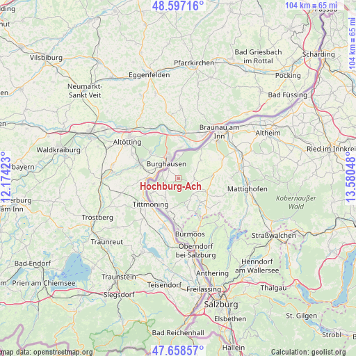
Hochburg-Ach GPS coordinates[2]
48° 7' 48.036" North, 12° 52' 38.46" East
| Map corner | latitude | longitude |
|---|---|---|
| Upper-left | 48.59716°, | 12.17423° |
| Center: | 48.13001°, | 12.87735° |
| Lower-right: | 47.65857°, | 13.58048° |
| Map W x H: | 104.4×104.4 km | = 64.9×64.9mi |
| max Lat: | 48.98333° ⇑25.7% North |
| Hochburg-Ach: | 48.13001° |
| min Lat: | ⇓74.3% South 46.48841° |
| min Long | Hochburg-Ach | max Long |
| 9.57802° | 12.87735° | 17.1° |
| W 16%⇐ | ⇒84% E |
Elevation
Elevation of Hochburg-Ach is 462 m = 1516 ft, and this is 43.5 m = 143 ft below average elevation for this country.
| Max E: |
2140 m = 7021 ft | 48.2% |
| Avg. | 505.5 m = 1658 ft | |
| Hochburg-Ach | 462 m = 1516 ft | |
Min E: |
118 m = 387 ft | 51.8% |
See also: Austria elevation on elevation.city.
Geographical zone
Hochburg-Ach is located in North temperate zone (between Tropic of Cancer and the Arctic Circle). Distance of this North polar circle is 2049.6 km =1273.6 mi to North.| Distance of | km | miles | from Hochburg-Ach |
|---|---|---|---|
| North Pole | 4655.5 | 2892.8 | to North |
| Arctic Circle | 2049.6 | 1273.6 | to North |
| Tropic Cancer | 2745.6 | 1706 | to South |
| Equator | 5351.6 | 3325.3 | to South |


Nearby cities:
15 places around Hochburg-Ach: (largest is in red/bold)
• Bürmoos
16.6 km =10.3 mi,  169°
169°
• Dorfbeuern
16.3 km =10.1 mi,  140°
140°
• Duttendorf
3 km =1.9 mi,  317°
317°
• Eggelsberg
10.1 km =6.3 mi,  123°
123°
• Friedrichsdorf
14.1 km =8.8 mi,  69°
69°
• Handenberg
9.7 km =6 mi,  87°
87°
• Lamprechtshausen
16.5 km =10.3 mi,  159°
159°
• Moosdorf
12.6 km =7.8 mi, 138°
• Ostermiething
10 km =6.2 mi,  200°
200°
• Osternberg
17 km =10.6 mi,  41°
41°
• Ranshofen
15.4 km =9.6 mi, 41°
• Riedersbach
12 km =7.5 mi,  190°
190°
• Sankt Georgen am Fillmannsbach
9.7 km =6 mi, 92°
• Sankt Pantaleon
13.7 km =8.5 mi, 174°
• Wagnergraben
16.3 km =10.1 mi, 138°
Sources, notices
• [Note1] Compared only with cities in Austria existing in our database
• [Src1] Map data: © OpenStreetMap contributors (CC-BY-SA)
• [Src2] Other city data from geonames.org with taken over terms of usage.
• [Src3] Geographical zone / Annual Mean Temperature by Robert A. Rohde @ Wikipedia
