Hartl geodata
Hartl (Styria) is a seat of a third-order administrative division; located in Austria in Europe/Vienna (GMT+2) time zone. With population of 796 people, there are 1622 cities with bigger population in this country. Compared to other cities in Austria, 74.1% of cities are located further ↑North; 77.9% of cities are located further ←West and 58.5% of cities have higher elevation than Hartl. Note1
Administrative division(s):
- Level 1: Styria
- Level 2: Politischer Bezirk Hartberg-Fürstenfeld
- Level 3: Hartl


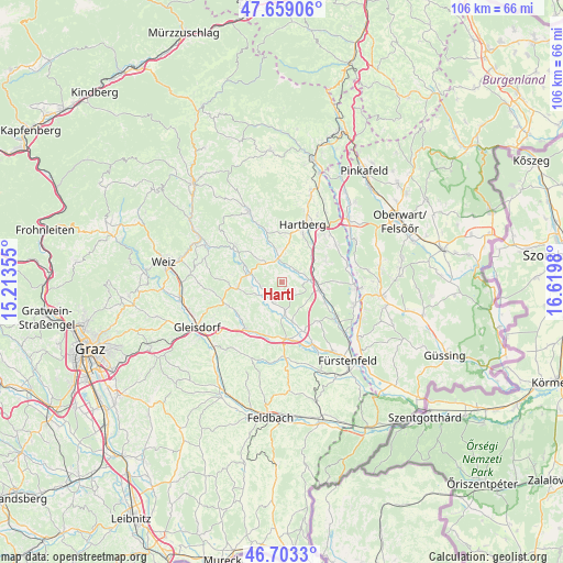
Hartl GPS coordinates[2]
47° 10' 59.988" North, 15° 55' 0.012" East
| Map corner | latitude | longitude |
|---|---|---|
| Upper-left | 47.65906°, | 15.21355° |
| Center: | 47.18333°, | 15.91667° |
| Lower-right: | 46.7033°, | 16.6198° |
| Map W x H: | 106.3×106.3 km | = 66.1×66.1mi |
| max Lat: | 48.98333° ⇑74.1% North |
| Hartl: | 47.18333° |
| min Lat: | ⇓25.9% South 46.48841° |
| min Long | Hartl | max Long |
| 9.57802° | 15.91667° | 17.1° |
| W 77.9%⇐ | ⇒22.1% E |
Elevation
Elevation of Hartl is 394 m = 1293 ft, and this is 111.5 m = 366 ft below average elevation for this country.
| Max E: |
2140 m = 7021 ft | 58.5% |
| Avg. | 505.5 m = 1658 ft | |
| Hartl | 394 m = 1293 ft | |
Min E: |
118 m = 387 ft | 41.5% |
See also: Austria elevation on elevation.city.
Geographical zone
Hartl is located in North temperate zone (between Tropic of Cancer and the Arctic Circle). Distance of this North polar circle is 2154.9 km =1339 mi to North.| Distance of | km | miles | from Hartl |
|---|---|---|---|
| North Pole | 4760.8 | 2958.2 | to North |
| Arctic Circle | 2154.9 | 1339 | to North |
| Tropic Cancer | 2640.4 | 1640.7 | to South |
| Equator | 5246.3 | 3259.9 | to South |


Nearby cities:
15 places around Hartl: (largest is in red/bold)
• Bad Waltersdorf
7.1 km =4.4 mi,  102°
102°
• Blaindorf
3.8 km =2.4 mi,  255°
255°
• Dienersdorf
6.4 km =4 mi,  349°
349°
• Ebersdorf
3.8 km =2.4 mi,  63°
63°
• Gersdorf an der Feistritz
5.4 km =3.4 mi,  249°
249°
• Grosshart
3.1 km =1.9 mi,  126°
126°
• Grosssteinbach
4.5 km =2.8 mi,  214°
214°
• Hainersdorf
7.9 km =4.9 mi,  164°
164°
• Hirnsdorf
6.7 km =4.2 mi,  277°
277°
• Hofkirchen
7.1 km =4.4 mi, 345°
• Kaibing
6.6 km =4.1 mi,  286°
286°
• Kaindorf
4.7 km =2.9 mi, 354°
• Pischelsdorf in der Steiermark
8.4 km =5.2 mi, 263°
• Sebersdorf
5.8 km =3.6 mi,  86°
86°
• Unterbuch
7.4 km =4.6 mi,  48°
48°
Sources, notices
• [Note1] Compared only with cities in Austria existing in our database
• [Src1] Map data: © OpenStreetMap contributors (CC-BY-SA)
• [Src2] Other city data from geonames.org with taken over terms of usage.
• [Src3] Geographical zone / Annual Mean Temperature by Robert A. Rohde @ Wikipedia
