Unterbuch geodata
Unterbuch (Styria) is a populated place; located in Austria in Europe/Vienna (GMT+2) time zone. With population of 596 people, there are 2153 cities with bigger population in this country. Compared to other cities in Austria, 70.5% of cities are located further ↑North; 80% of cities are located further ←West and 71.1% of cities have higher elevation than Unterbuch. Note1
Administrative division(s):
- Level 1: Styria
- Level 2: Politischer Bezirk Hartberg-Fürstenfeld
- Level 3: Buch-St. Magdalena


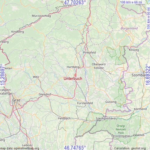
Unterbuch GPS coordinates[2]
47° 13' 38.244" North, 15° 59' 24.324" East
| Map corner | latitude | longitude |
|---|---|---|
| Upper-left | 47.70263°, | 15.28697° |
| Center: | 47.22729°, | 15.99009° |
| Lower-right: | 46.74765°, | 16.69322° |
| Map W x H: | 106.2×106.2 km | = 66×66mi |
| max Lat: | 48.98333° ⇑70.5% North |
| Unterbuch: | 47.22729° |
| min Lat: | ⇓29.5% South 46.48841° |
| min Long | Unterbuch | max Long |
| 9.57802° | 15.99009° | 17.1° |
| W 80%⇐ | ⇒20% E |
Elevation
Elevation of Unterbuch is 322 m = 1056 ft, and this is 183.5 m = 602 ft below average elevation for this country.
| Max E: |
2140 m = 7021 ft | 71.1% |
| Avg. | 505.5 m = 1658 ft | |
| Unterbuch | 322 m = 1056 ft | |
Min E: |
118 m = 387 ft | 28.9% |
See also: Austria elevation on elevation.city.
Geographical zone
Unterbuch is located in North temperate zone (between Tropic of Cancer and the Arctic Circle). Distance of this North polar circle is 2150 km =1335.9 mi to North.| Distance of | km | miles | from Unterbuch |
|---|---|---|---|
| North Pole | 4755.9 | 2955.2 | to North |
| Arctic Circle | 2150 | 1335.9 | to North |
| Tropic Cancer | 2645.3 | 1643.7 | to South |
| Equator | 5251.2 | 3262.9 | to South |


Nearby cities:
15 places around Unterbuch: (largest is in red/bold)
• Bad Waltersdorf
6.6 km =4.1 mi,  167°
167°
• Dienersdorf
6.8 km =4.2 mi,  281°
281°
• Ebersdorf
3.8 km =2.4 mi,  213°
213°
• Flattendorf
7.1 km =4.4 mi,  308°
308°
• Grosshart
7.4 km =4.6 mi,  204°
204°
• Hartberg
6.5 km =4 mi,  344°
344°
• Hartl
7.4 km =4.6 mi,  228°
228°
• Hofkirchen
7.6 km =4.7 mi,  285°
285°
• Kaindorf
6 km =3.7 mi,  267°
267°
• Ring
6.9 km =4.3 mi, 343°
• Safenau
4.4 km =2.7 mi,  353°
353°
• Sankt Johann in der Haide
6.5 km =4 mi,  24°
24°
• Sebersdorf
4.5 km =2.8 mi,  176°
176°
• Unterrohr
5.2 km =3.2 mi,  60°
60°
• Wörth an der Lafnitz
7 km =4.3 mi,  102°
102°
Sources, notices
• [Note1] Compared only with cities in Austria existing in our database
• [Src1] Map data: © OpenStreetMap contributors (CC-BY-SA)
• [Src2] Other city data from geonames.org with taken over terms of usage.
• [Src3] Geographical zone / Annual Mean Temperature by Robert A. Rohde @ Wikipedia
