Gaishorn geodata
Gaishorn (Styria) is a populated place; located in Austria in Europe/Vienna (GMT+2) time zone. With population of 589 people, there are 2170 cities with bigger population in this country. Compared to other cities in Austria, 54.1% of cities are located further ↑North; 52.4% of cities are located further →East and 77.6% of cities have lower elevation than Gaishorn. Note1
Administrative division(s):
- Level 1: Styria
- Level 2: Politischer Bezirk Liezen
- Level 3: Gaishorn am See


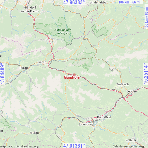
Gaishorn GPS coordinates[2]
47° 29' 27.132" North, 14° 32' 52.836" East
| Map corner | latitude | longitude |
|---|---|---|
| Upper-left | 47.96383°, | 13.84489° |
| Center: | 47.49087°, | 14.54801° |
| Lower-right: | 47.01361°, | 15.25114° |
| Map W x H: | 105.7×105.7 km | = 65.7×65.7mi |
| max Lat: | 48.98333° ⇑54.1% North |
| Gaishorn: | 47.49087° |
| min Lat: | ⇓45.9% South 46.48841° |
| min Long | Gaishorn | max Long |
| 9.57802° | 14.54801° | 17.1° |
| W 47.6%⇐ | ⇒52.4% E |
Elevation
Elevation of Gaishorn is 682 m = 2238 ft, and this is 176.5 m = 579 ft above average elevation for this country.
| Max E: |
2140 m = 7021 ft | 22.4% |
| Gaishorn | 682 m 2238 ft | |
| Avg. | 505.5 m = 1658 ft | |
Min E: |
118 m = 387 ft | 77.6% |
See also: Austria elevation on elevation.city.
Geographical zone
Gaishorn is located in North temperate zone (between Tropic of Cancer and the Arctic Circle). Distance of this North polar circle is 2120.7 km =1317.7 mi to North.| Distance of | km | miles | from Gaishorn |
|---|---|---|---|
| North Pole | 4726.6 | 2937 | to North |
| Arctic Circle | 2120.7 | 1317.7 | to North |
| Tropic Cancer | 2674.6 | 1661.9 | to South |
| Equator | 5280.5 | 3281.1 | to South |


Nearby cities:
15 places around Gaishorn: (largest is in red/bold)
• Admont
11.5 km =7.1 mi,  325°
325°
• Ardning
17.8 km =11.1 mi,  308°
308°
• Boder
14.4 km =8.9 mi,  289°
289°
• Bruckmühl
16.8 km =10.4 mi, 286°
• Hall bei Admont
12.4 km =7.7 mi, 329°
• Hohentauern
8 km =5 mi,  217°
217°
• Johnsbach
5.4 km =3.4 mi,  29°
29°
• Kalwang
17.1 km =10.6 mi,  114°
114°
• Klausner
17.6 km =10.9 mi,  302°
302°
• Rottenmann
15.1 km =9.4 mi,  280°
280°
• Sankt Johann am Tauern
16.8 km =10.4 mi,  201°
201°
• Treglwang
3.7 km =2.3 mi,  119°
119°
• Trieben
4.6 km =2.9 mi,  262°
262°
• Wald am Schoberpaß
10.6 km =6.6 mi, 115°
• Weng im Gesäuse
12.8 km =8 mi,  344°
344°
Sources, notices
• [Note1] Compared only with cities in Austria existing in our database
• [Src1] Map data: © OpenStreetMap contributors (CC-BY-SA)
• [Src2] Other city data from geonames.org with taken over terms of usage.
• [Src3] Geographical zone / Annual Mean Temperature by Robert A. Rohde @ Wikipedia
