Weng im Gesäuse geodata
Weng im Gesäuse (Styria) is a populated place; located in Austria in Europe/Vienna (GMT+2) time zone. With population of 548 people, there are 2329 cities with bigger population in this country. Compared to other cities in Austria, 50.7% of cities are located further ↓South; 53.1% of cities are located further →East and 79.7% of cities have lower elevation than Weng im Gesäuse. Note1


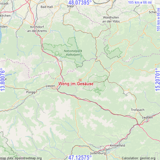
Weng im Gesäuse GPS coordinates[2]
47° 36' 7.2" North, 14° 30' 13.968" East
| Map corner | latitude | longitude |
|---|---|---|
| Upper-left | 48.07395°, | 13.80076° |
| Center: | 47.602°, | 14.50388° |
| Lower-right: | 47.12575°, | 15.20701° |
| Map W x H: | 105.4×105.4 km | = 65.5×65.5mi |
| max Lat: | 48.98333° ⇑49.3% North |
| Weng im Gesäuse: | 47.602° |
| min Lat: | ⇓50.7% South 46.48841° |
| min Long | Weng im Gesäus | max Long |
| 9.57802° | 14.50388° | 17.1° |
| W 46.9%⇐ | ⇒53.1% E |
Elevation
Elevation of Weng im Gesäuse is 710 m = 2329 ft, and this is 204.5 m = 671 ft above average elevation for this country.
| Max E: |
2140 m = 7021 ft | 20.3% |
| Weng im Gesäuse | 710 m 2329 ft | |
| Avg. | 505.5 m = 1658 ft | |
Min E: |
118 m = 387 ft | 79.7% |
See also: Austria elevation on elevation.city.
Geographical zone
Weng im Gesäuse is located in North temperate zone (between Tropic of Cancer and the Arctic Circle). Distance of this North polar circle is 2108.3 km =1310 mi to North.| Distance of | km | miles | from Weng im Gesäuse |
|---|---|---|---|
| North Pole | 4714.2 | 2929.3 | to North |
| Arctic Circle | 2108.3 | 1310 | to North |
| Tropic Cancer | 2686.9 | 1669.6 | to South |
| Equator | 5292.8 | 3288.8 | to South |


Nearby cities:
15 places around Weng im Gesäuse: (largest is in red/bold)
• Admont
4.4 km =2.7 mi,  227°
227°
• Altenmarkt bei Sankt Gallen
17.3 km =10.7 mi,  38°
38°
• Ardning
10.6 km =6.6 mi,  263°
263°
• Boder
12.8 km =8 mi, 233°
• Bruckmühl
14.9 km =9.3 mi,  239°
239°
• Gaishorn
12.8 km =8 mi,  164°
164°
• Hall bei Admont
3.4 km =2.1 mi, 241°
• Johnsbach
9.7 km =6 mi,  142°
142°
• Klausner
11.9 km =7.4 mi, 255°
• Rottenmann
14.9 km =9.3 mi, 230°
• Sankt Gallen
12.6 km =7.8 mi, 42°
• Selzthal
15.5 km =9.6 mi,  248°
248°
• Spital am Pyhrn
14.1 km =8.8 mi,  299°
299°
• Treglwang
15.6 km =9.7 mi, 155°
• Trieben
13 km =8.1 mi,  185°
185°
Sources, notices
• [Note1] Compared only with cities in Austria existing in our database
• [Src1] Map data: © OpenStreetMap contributors (CC-BY-SA)
• [Src2] Other city data from geonames.org with taken over terms of usage.
• [Src3] Geographical zone / Annual Mean Temperature by Robert A. Rohde @ Wikipedia
