Johnsbach geodata
Johnsbach (Styria) is a seat of a third-order administrative division; located in Austria in Europe/Vienna (GMT+2) time zone. With population of 154 people, there are 2891 cities with bigger population in this country. Compared to other cities in Austria, 52.3% of cities are located further ↑North; 52% of cities are located further →East and 96% of cities have lower elevation than Johnsbach. Note1


Johnsbach GPS coordinates[2]
47° 31' 59.988" North, 14° 34' 59.988" East
| Map corner | latitude | longitude |
|---|---|---|
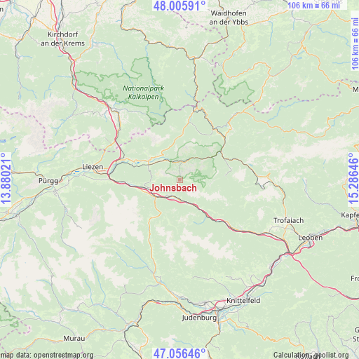
| Upper-left | 48.00591°, | 13.88021° |
| Center: | 47.53333°, | 14.58333° |
| Lower-right: | 47.05646°, | 15.28646° |
| Map W x H: | 105.6×105.6 km | = 65.6×65.6mi |
| max Lat: | 48.98333° ⇑52.3% North |
| Johnsbach: | 47.53333° |
| min Lat: | ⇓47.7% South 46.48841° |
| min Long | Johnsbach | max Long |
| 9.57802° | 14.58333° | 17.1° |
| W 48%⇐ | ⇒52% E |
Elevation
Elevation of Johnsbach is 1067 m = 3501 ft, and this is 561.5 m = 1842 ft above average elevation for this country.
| Max E: |
2140 m = 7021 ft | 4% |
| Johnsbach | 1067 m 3501 ft | |
| Avg. | 505.5 m = 1658 ft | |
Min E: |
118 m = 387 ft | 96% |
See also: Austria elevation on elevation.city.
Geographical zone
Johnsbach is located in North temperate zone (between Tropic of Cancer and the Arctic Circle). Distance of this North polar circle is 2116 km =1314.8 mi to North.| Distance of | km | miles | from Johnsbach |
|---|---|---|---|
| North Pole | 4721.9 | 2934.1 | to North |
| Arctic Circle | 2116 | 1314.8 | to North |
| Tropic Cancer | 2679.3 | 1664.8 | to South |
| Equator | 5285.2 | 3284.1 | to South |


Nearby cities:
15 places around Johnsbach: (largest is in red/bold)
• Admont
10.3 km =6.4 mi,  296°
296°
• Ardning
17.7 km =11 mi,  291°
291°
• Boder
16.3 km =10.1 mi,  270°
270°
• Gaishorn
5.4 km =3.4 mi,  209°
209°
• Hall bei Admont
10.8 km =6.7 mi, 303°
• Hieflau
14.6 km =9.1 mi,  56°
56°
• Hohentauern
13.4 km =8.3 mi, 214°
• Kalwang
17.5 km =10.9 mi,  132°
132°
• Landl
17.7 km =11 mi,  39°
39°
• Rottenmann
17.6 km =10.9 mi,  263°
263°
• Sankt Gallen
17.2 km =10.7 mi,  8°
8°
• Treglwang
6.6 km =4.1 mi,  175°
175°
• Trieben
8.9 km =5.5 mi,  233°
233°
• Wald am Schoberpaß
11.6 km =7.2 mi,  143°
143°
• Weng im Gesäuse
9.7 km =6 mi,  322°
322°
Sources, notices
• [Note1] Compared only with cities in Austria existing in our database
• [Src1] Map data: © OpenStreetMap contributors (CC-BY-SA)
• [Src2] Other city data from geonames.org with taken over terms of usage.
• [Src3] Geographical zone / Annual Mean Temperature by Robert A. Rohde @ Wikipedia
