Freindorf geodata
Freindorf (Upper Austria) is a populated place; located in Austria in Europe/Vienna (GMT+2) time zone. With population of 2,320 people, there are 523 cities with bigger population in this country. Compared to other cities in Austria, 81.1% of cities are located further ↓South; 58% of cities are located further →East and 82.7% of cities have higher elevation than Freindorf. Note1
Administrative division(s):
- Level 1: Upper Austria
- Level 2: Politischer Bezirk Linz-Land
- Level 3: Ansfelden


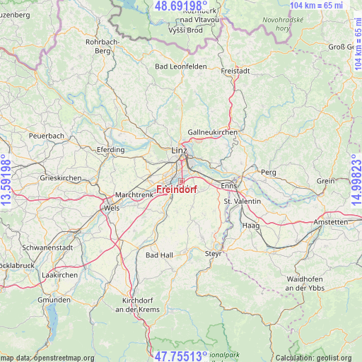
Freindorf GPS coordinates[2]
48° 13' 32.52" North, 14° 17' 42.36" East
| Map corner | latitude | longitude |
|---|---|---|
| Upper-left | 48.69198°, | 13.59198° |
| Center: | 48.2257°, | 14.2951° |
| Lower-right: | 47.75513°, | 14.99823° |
| Map W x H: | 104.2×104.2 km | = 64.7×64.7mi |
| max Lat: | 48.98333° ⇑18.9% North |
| Freindorf: | 48.2257° |
| min Lat: | ⇓81.1% South 46.48841° |
| min Long | Freindorf | max Long |
| 9.57802° | 14.2951° | 17.1° |
| W 42%⇐ | ⇒58% E |
Elevation
Elevation of Freindorf is 261 m = 856 ft, and this is 244.5 m = 802 ft below average elevation for this country.
| Max E: |
2140 m = 7021 ft | 82.7% |
| Avg. | 505.5 m = 1658 ft | |
| Freindorf | 261 m = 856 ft | |
Min E: |
118 m = 387 ft | 17.3% |
See also: Austria elevation on elevation.city.
Geographical zone
Freindorf is located in North temperate zone (between Tropic of Cancer and the Arctic Circle). Distance of this North polar circle is 2039 km =1267 mi to North.| Distance of | km | miles | from Freindorf |
|---|---|---|---|
| North Pole | 4644.9 | 2886.2 | to North |
| Arctic Circle | 2039 | 1267 | to North |
| Tropic Cancer | 2756.3 | 1712.7 | to South |
| Equator | 5362.2 | 3331.9 | to South |


Nearby cities:
15 places around Freindorf: (largest is in red/bold)
• Ansfelden
1.8 km =1.1 mi,  191°
191°
• Audorf
1.4 km =0.9 mi,  234°
234°
• Doppl
3.9 km =2.4 mi,  309°
309°
• Haag
5.4 km =3.4 mi,  338°
338°
• Haid
4 km =2.5 mi, 234°
• Hart
5.2 km =3.2 mi,  327°
327°
• Kinderdorf Sankt Isidor
4.8 km =3 mi, 333°
• Kremsdorf
3.7 km =2.3 mi,  220°
220°
• Langholzfeld
4 km =2.5 mi,  298°
298°
• Rapperswinkel
2.8 km =1.7 mi,  241°
241°
• Rohrbach
4.2 km =2.6 mi,  103°
103°
• Sankt Dionysen
3 km =1.9 mi,  267°
267°
• Sankt Martin
2.1 km =1.3 mi,  285°
285°
• Traun
4.5 km =2.8 mi, 271°
• Wagram
5 km =3.1 mi, 286°
Sources, notices
• [Note1] Compared only with cities in Austria existing in our database
• [Src1] Map data: © OpenStreetMap contributors (CC-BY-SA)
• [Src2] Other city data from geonames.org with taken over terms of usage.
• [Src3] Geographical zone / Annual Mean Temperature by Robert A. Rohde @ Wikipedia
