Sankt Ulrich am Pillersee geodata
Sankt Ulrich am Pillersee (Tyrol) is a populated place; located in Austria in Europe/Vienna (GMT+2) time zone. With population of 1,819 people, there are 683 cities with bigger population in this country. Compared to other cities in Austria, 52.5% of cities are located further ↑North; 85.7% of cities are located further →East and 88.1% of cities have lower elevation than Sankt Ulrich am Pillersee. Note1
Administrative division(s):
- Level 1: Tyrol
- Level 2: Politischer Bezirk Kitzbühel
- Level 3: St. Ulrich am Pillersee
Current local time in Sankt Ulrich am Pillersee:
11:56 PM, FridayDifference from your time zone: hours


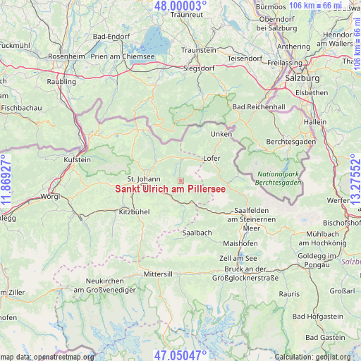
Sankt Ulrich am Pillersee GPS coordinates[2]
47° 31' 38.64" North, 12° 34' 20.604" East
| Map corner | latitude | longitude |
|---|---|---|
| Upper-left | 48.00003°, | 11.86927° |
| Center: | 47.5274°, | 12.57239° |
| Lower-right: | 47.05047°, | 13.27552° |
| Map W x H: | 105.6×105.6 km | = 65.6×65.6mi |
| max Lat: | 48.98333° ⇑52.5% North |
| Sankt Ulrich am Pillersee: | 47.5274° |
| min Lat: | ⇓47.5% South 46.48841° |
| min Long | Sankt Ulrich am | max Long |
| 9.57802° | 12.57239° | 17.1° |
| W 14.3%⇐ | ⇒85.7% E |
Elevation
Elevation of Sankt Ulrich am Pillersee is 845 m = 2772 ft, and this is 339.5 m = 1114 ft above average elevation for this country.
| Max E: |
2140 m = 7021 ft | 11.9% |
| Sankt Ulrich am Pillersee | 845 m 2772 ft | |
| Avg. | 505.5 m = 1658 ft | |
Min E: |
118 m = 387 ft | 88.1% |
See also: Austria elevation on elevation.city.
Geographical zone
Sankt Ulrich am Pillersee is located in North temperate zone (between Tropic of Cancer and the Arctic Circle). Distance of this North polar circle is 2116.6 km =1315.2 mi to North.| Distance of | km | miles | from Sankt Ulrich am Pillersee |
|---|---|---|---|
| North Pole | 4722.5 | 2934.4 | to North |
| Arctic Circle | 2116.6 | 1315.2 | to North |
| Tropic Cancer | 2678.6 | 1664.4 | to South |
| Equator | 5284.6 | 3283.7 | to South |


Nearby cities:
15 places around Sankt Ulrich am Pillersee: (largest is in red/bold)
• Aurach
16.8 km =10.4 mi,  220°
220°
• Erpfendorf
10.1 km =6.3 mi,  308°
308°
• Fieberbrunn
6.1 km =3.8 mi,  200°
200°
• Hinterglemm
16.8 km =10.4 mi,  173°
173°
• Hochfilzen
7.5 km =4.7 mi,  153°
153°
• Kirchdorf in Tirol
10.1 km =6.3 mi,  288°
288°
• Kitzbühel
16.3 km =10.1 mi,  236°
236°
• Lofer
11.1 km =6.9 mi,  54°
54°
• Oberndorf in Tirol
14.5 km =9 mi,  257°
257°
• Saalbach
15.9 km =9.9 mi,  162°
162°
• Sankt Jakob in Haus
3.5 km =2.2 mi,  208°
208°
• Sankt Johann in Tirol
11.2 km =7 mi,  267°
267°
• Sankt Martin bei Lofer
10.5 km =6.5 mi,  65°
65°
• Sonnberg
14.8 km =9.2 mi,  125°
125°
• Waidring
6.2 km =3.9 mi,  356°
356°
Sources, notices
• [Note1] Compared only with cities in Austria existing in our database
• [Src1] Map data: © OpenStreetMap contributors (CC-BY-SA)
• [Src2] Other city data from geonames.org with taken over terms of usage.
• [Src3] Geographical zone / Annual Mean Temperature by Robert A. Rohde @ Wikipedia
