Eggern geodata
Eggern (Lower Austria) is a seat of a third-order administrative division; located in Austria in Europe/Vienna (GMT+2) time zone. With population of 477 people, there are 2530 cities with bigger population in this country. Compared to other cities in Austria, 99.8% of cities are located further ↓South; 56.7% of cities are located further ←West and 69.1% of cities have lower elevation than Eggern. Note1
Administrative division(s):
- Level 1: Lower Austria
- Level 2: Politischer Bezirk Gmünd
- Level 3: Eggern


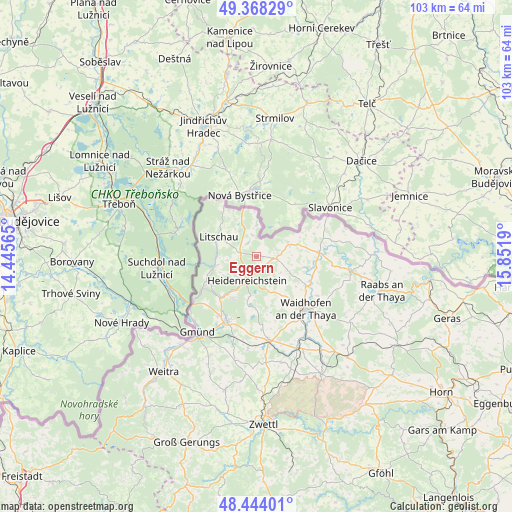
Eggern GPS coordinates[2]
48° 54' 29.844" North, 15° 8' 55.572" East
| Map corner | latitude | longitude |
|---|---|---|
| Upper-left | 49.36829°, | 14.44565° |
| Center: | 48.90829°, | 15.14877° |
| Lower-right: | 48.44401°, | 15.8519° |
| Map W x H: | 102.8×102.8 km | = 63.9×63.9mi |
| max Lat: | 48.98333° ⇑0.2% North |
| Eggern: | 48.90829° |
| min Lat: | ⇓99.8% South 46.48841° |
| min Long | Eggern | max Long |
| 9.57802° | 15.14877° | 17.1° |
| W 56.7%⇐ | ⇒43.3% E |
Elevation
Elevation of Eggern is 581 m = 1906 ft, and this is 75.5 m = 248 ft above average elevation for this country.
| Max E: |
2140 m = 7021 ft | 30.9% |
| Eggern | 581 m 1906 ft | |
| Avg. | 505.5 m = 1658 ft | |
Min E: |
118 m = 387 ft | 69.1% |
See also: Austria elevation on elevation.city.
Geographical zone
Eggern is located in North temperate zone (between Tropic of Cancer and the Arctic Circle). Distance of this North polar circle is 1963.1 km =1219.8 mi to North.| Distance of | km | miles | from Eggern |
|---|---|---|---|
| North Pole | 4569 | 2839 | to North |
| Arctic Circle | 1963.1 | 1219.8 | to North |
| Tropic Cancer | 2832.2 | 1759.8 | to South |
| Equator | 5438.1 | 3379.1 | to South |


Nearby cities:
15 places around Eggern: (largest is in red/bold)
• Altnagelberg
12.7 km =7.9 mi,  239°
239°
• Amaliendorf
9.6 km =6 mi,  209°
209°
• Dobersberg
12.7 km =7.9 mi,  86°
86°
• Eisgarn
3.5 km =2.2 mi,  285°
285°
• Gastern
5.4 km =3.4 mi,  106°
106°
• Haugschlag
11 km =6.8 mi,  319°
319°
• Heidenreichstein
5.2 km =3.2 mi, 206°
• Kautzen
7 km =4.3 mi,  69°
69°
• Litschau
8.6 km =5.3 mi,  297°
297°
• Reingers
6.6 km =4.1 mi,  350°
350°
• Schrems
15.1 km =9.4 mi,  203°
203°
• Thaya
11.8 km =7.3 mi,  120°
120°
• Vitis
16.7 km =10.4 mi,  171°
171°
• Waidhofen an der Thaya
14.2 km =8.8 mi,  135°
135°
• Waldkirchen an der Thaya
15 km =9.3 mi,  79°
79°
Sources, notices
• [Note1] Compared only with cities in Austria existing in our database
• [Src1] Map data: © OpenStreetMap contributors (CC-BY-SA)
• [Src2] Other city data from geonames.org with taken over terms of usage.
• [Src3] Geographical zone / Annual Mean Temperature by Robert A. Rohde @ Wikipedia
